
August 14, 2016. Yukon-Northwest Territories Border
DAY 1 (45km)
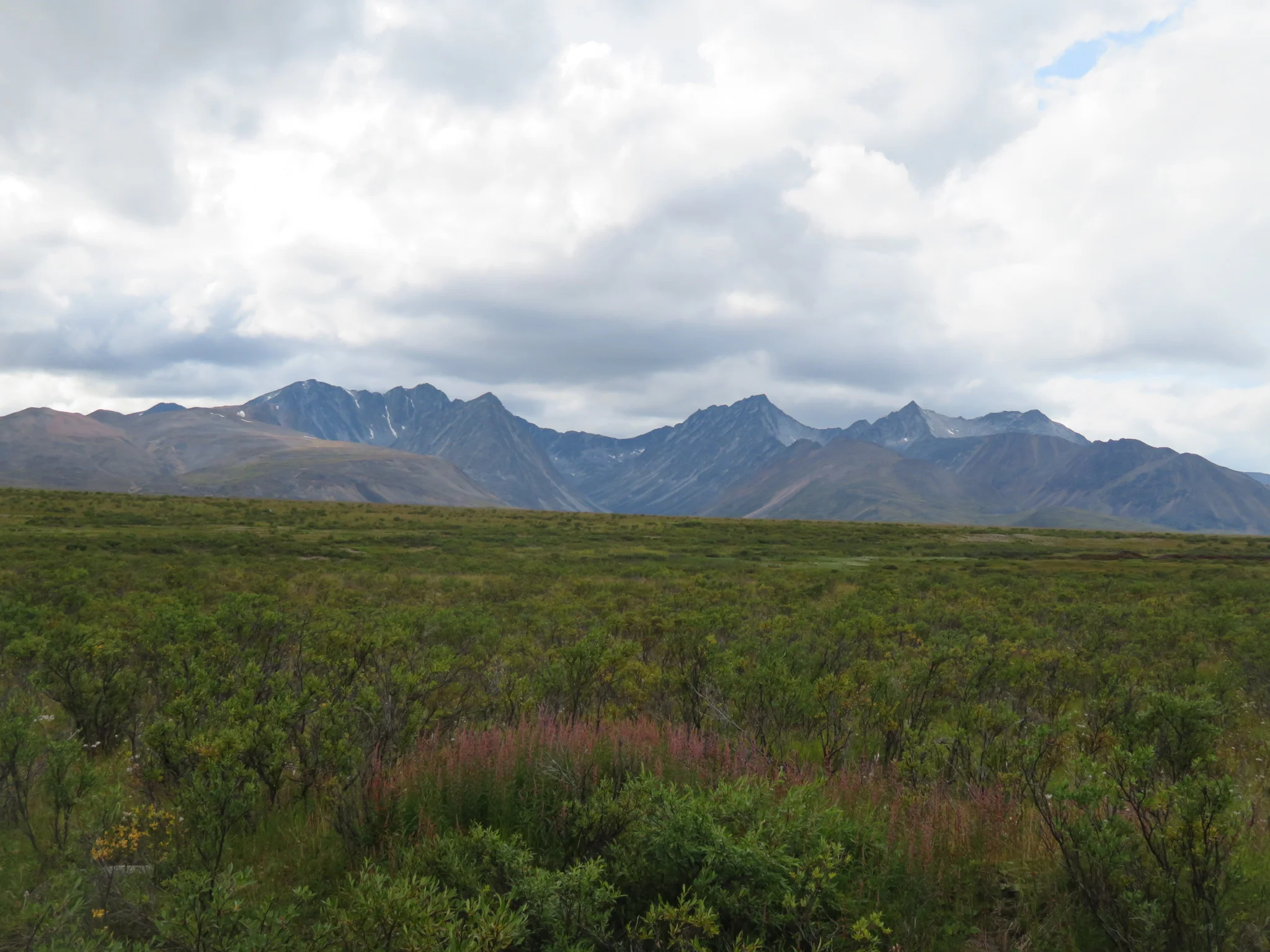
So this is where the trail starts. No services, no bridges, no problem. The Canol road and pipeline were build during world war 2 to bring oil for the defense of Alaska. Two years later it was shut down and while the Yukon maintains the road, it has been completely left for nature to reclaim in the Northwest Territories.
71 years later...
The first 16km are in perfect condition and lead to an airstrip where most hikers start or end their trip. I was lucky to meet Stan who has a lodge 5 hiking days into the trail but I am hoping to get there in 2 or 3. On an info board I also found another important piece of information: the trail length. 380 kilometers from here to Norman Wells. It's funny that over the 3 hectic days I had in town, this was the one thing I overlooked.
Sucks to be the yahoo without much preparation or a sat phone but it's either do it now or never.
The trail was still good, aside from a fair amount of stream crossings. Nothing major just kept my feet cold and wet throughout. Even the uphills were perfectly rideable.
I met one of the two other groups out on the trail, two hikers from Ontario and Belgium. We chatted for a bit and it seems like hiking this requires a lot of planning. Fly from Norman wells and drop off 3 food caches. A sat phone is on hand for weather, emergency and pickup from the Mackenzie river at the end. I would have loved to hang around and camp together but there was no way I can sleep warm at 1600m, I also got a hint of a small hut 7 miles ahead at the Intga river.
The trail descended nicely to the river where I found the small hut. A warm cozy place and a river, what more could you ask for? End of day 1, 45km and the trail is a little too good to be true. This is the 3rd day from Ross River and I am doing well on supplies, I havent even opened any of the freezedried stuff I packed but the nutella is almost gone.
DAY 2 (66km)
Morning had me going knee deep across the Intga, the frame bag caught the current like a sail but it wasnt bad, something to keep in mind though.
The trail up to caribou pass was perfect and rideable uphill, not even in granny gear.
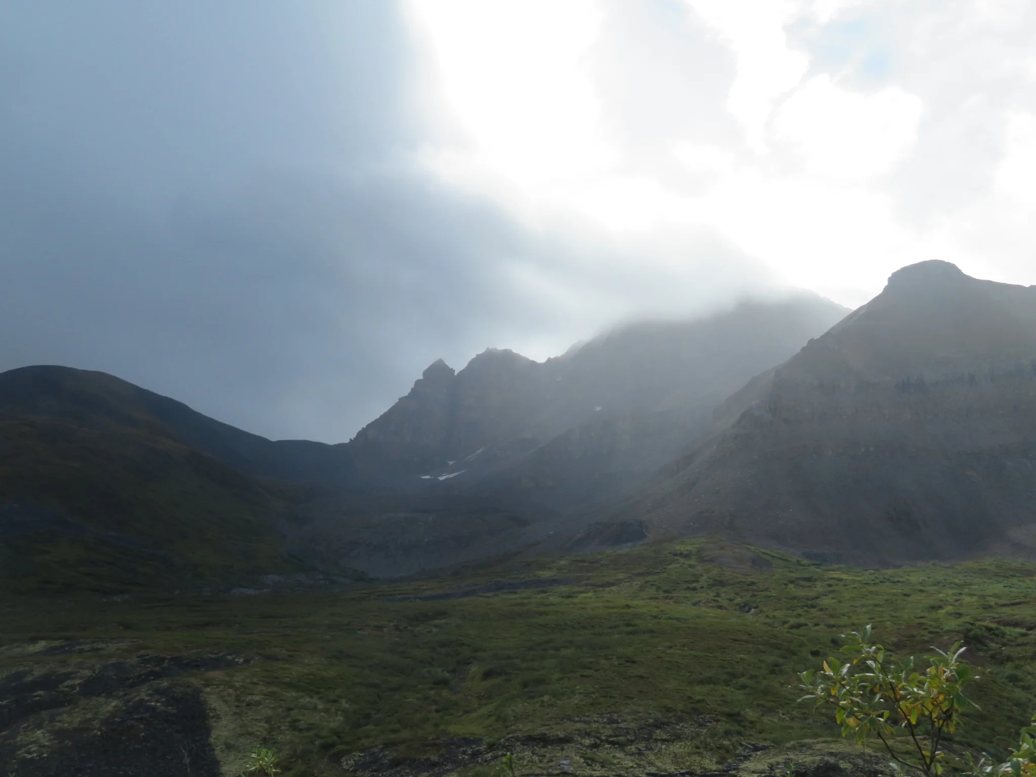
The descent was good except for a short bouldery section and two river crossings with a slippery orange bottom. The size and texture of the mountains was unreal.
and the size and texture of bear signs was also worrying!
After some scouting I found a suitable spot for the last crossing of the Ekwi River. A little over the knee in depth but very strong current. The bike went perpendicular to me and I slowly made my way across while keeping the front brake locked. I was later told that this is one of the toughest crossings and this is unusually low level.
In less than a day and a half I made it to the Ramhead outfitters. They mostly take people to hunting trips but also help hikers with food drops and logistics. I am the 6th person on the trail this year, aside from the group of two I met earlier there are three 70 year olds ahead of me.
"It's their last hike, they did the Appalacian, PCT and CDT," said Stan. I made it a note to catch up to them and tell them it shouldn't be their last hike.
Stan gave me the run of the trail, the Twitya crossing, the Little Keele shortcut and recommended I go upstream to an oil camp on the Mackenzie if the weather isnt calm for me to cross it. After an amazing meal and a pack of pastries I was off.
DAY 3 (34km)
One thing was clear - I was going too fast. With the alarm off, I woke up at 7 to the howl of the wolves. Less than a kilometer or two away, no snooze button, I just packed up. I kept looking through the trees to the lake but didn't catch a glimpse of any. Then I did it. I howled too and then they all suddenly stopped...
After a muddy trail I got to the muddy Godlin river which turned out to be the easiest river crossing so far, it was like walking your bike across the sidewalk. More amazing trail followed with few washouts around river bends and some roadless wandering across large spring melt washes. Those can get a little rough but it makes you shiver trying to imagine the amount of water running down here during a spring storm.
I was told there were some people picking up the old telegraph cable because wildlife was getting caught on it. I too almost got caught. Soon enough, the trail was cleared and I landed into the camp. Over coffee and lunch, I waited out the rain. The 16 people in the camp are all natives from Norman Wells and Tulia and they are here for the second year in a row. Aside from being the most awesome summer job ever, they get to spend 2.5 months in the wilderness. The whole project involves few camp moves via helicopter and lots of hours of rolling up the cable and trail building. The future for the Canol trail is looking bright and its thanks to these awesome people!
"Do you carry a gun or a rifle?"
"No... just an expired bear spray."
"What's wrong with you?"
Few hours later I opted for an early camp and some quality dry feet time. But one thing never stopped bothering me - why are so few people doing this trail?
DAY 4 (39km)
I quickly reached the mile 142 boglands. The roadbed seemed to disappear into bog and grass and oil filled water. Few handfuls of blueberries later I had no clue where the road was.
After some scouting I found the road again. Looks like this is as far as some ATV expedition got.
the road.
There was one hill before the Twitya river and for the most part it was overgrown but rideable if you dont mind getting whipped and slashed by alder. Note to self, bring gaitors or pants next time. But the views of the Twitya were definitely worth it.
I missed my planned launch point and instead of a 2 mile float, I pushed through the boggy trail. The set up took only 20 minutes and after a near-miss involving getting spun by current and overhanging trees I was floating down the river.
Trail was few hundred meters up from the Deca creek, definitely worth floating down, good landing spot and you save yourself pathfinding over the big wash. The good news was that the guys working on the telegraph cables have been here. The trail was mostly clear and easier to ride.
I opted for a gravel pit camp with views of the Tigonankweine and believe it or not, the first time ever a fire. Maybe I will have dry feet for few hours tomorrow!
DAY 5 (29km)
Today I drop down to Trout Creek, Stan said that would be the toughest part. It began with good road mixed with big washouts.
At this bed and stove stop, I assembled my franken-backpack, putting as much weight there as I can to make hauling the bike easier. What followed was some pretty hopeless pushing and pulling uphill and upstream.
For small parts I found good roadbed but then it was gone again, alternating between a game trail in the woods and the big boulders of the creek was the only choice.
Spotting some rolled cable and cut firewood meant it was done. All in all, 2-3 hours - a small price to pay for being out here.
The road up to Devil's pass was good and it was nice to gain some altitude.
There were two options and as one seemed to lead to a pretty impassable cliff, probably a 5.9, I took the right, high route.
Around the corner was the mile 108 camp and the old hut, the Canol Hilton. After a quick look at food supplies, I have about 6-7 days left. A rest day here would be nice, although I am not sure if I want to stick to my initial plan of climbing one of those nearby mountains.
Once a lively camp, now a barely standing ghost town
Pumphouse 108
DAY 6 (8km)
A quick rescue mission was in order for my bike shorts who fell out few kilometers back, then since I was there I went up the mountain. Looks like I wasnt the first one there.
I completed a nice loop returning back to the hut and as an added bonus I scouted the road and made a note to take the riverbed for few miles to avoid the endless slides who had taken over the road.
wanna see a magic trick? You see the road? Bam - it's gone!
Nortern lights were out and so was I, goofing around until the moon came out and the cold finally got me.
DAY 7 (40km)
Devil's pass was one of the most beautiful descends I have ever done, The perfect weather, light and scenery for some serious neck strain! Forward, left, right, back.
Oh wait... where did the road go?
Bushwack like a caribou! thats the way to go
At Andy creek I wondered if I should stop, as the climb to plains of Abraham was long and the elevation was too high for me to sleep warm.
But since the sun was shining, why not.
I settled for this odd hut at 1600m, it would be a chilly night so I opted for double rations of dehydrated meals. One doesnt do much anyway.
gnarly!
DAY 8 (53km)
Road was rad but bumpy enough to be slightly annoying, then it disappeared into the creek resulting in some pushing. Not nearly as bad as going uphill on trout creek.
After few hours there were two options: high or low route and I took the low, which deteriorated quickly and had me b-lining to the flat riverbed,
collect pokemon go!
nothing gets you ready for a float like some Mac and Cheese... product :(
The map showed another road further down before some raids, so I inflated the raft and went in the river. It was quite fast and without much experience, scary at first. I slowly got used to the rougher sections and knew the best channels to follow, eventually a big rapid sigaled the end of my rafting adventure.
The question was, how good is this road. And the answer is no. Just no. It must have been only cleared but not built, the entire thing was bumpy, soft and watery muskeg. The worst. I had to lift the bike every few steps, take breaks every few steps and with the rapids in view I knew that this was the only choice. Camping was not an option, hordes of mosquitoes, no flat or dry space and how could I possibly sleep knowing this awaits me tomorrow.
this will make you forget your dreams and crush your hopes.
After 6 hours of the most difficult pushing, pulling and carrying I cleared the Muskeg of Madness. It was dark, the yellow moon was out, the fire was burning and the aurora shone across the sky. A night to remember.
Day 9 (25km)
It was already warm when I woke up, I rafted across the little keele - at this point very fast and deep river.
yay selfie stick!
2 fairly big hills of good road followed.
Once it descended the road dissolved into a creek, little did I know this is the last road for the next 13 hours.
I finally caught up to the 3 70 year olds hiking this trail. Except there were two of them. It was the river.
It didnt hit me until later. One moment your friend is there and the next he isnt. I couldnt sleep much that night but all I could do now is get to town as quickly as possible and go to the RCMP. The man who drowned had all their electronics including the sat phone.
DAY 10 (62km)
5am start, 4am yukon time for me. Progress through the dodo canyon was good but later pushing became more difficult.
A big slide had created a lake in the way. Steep canyon walls on each side and a deep, deep bottom.
and in case you were thinking of scrambling the mountainside....
It was beautiful but plain miserable, 10 hours of no road finally took me to past the Caricajou #2. From here it should be quad-able to the Mackenzie.
When it was good, it was good. When it was bad, it was terrible. waist deep bog, impassable bush and skinnydipping my cut legs into disgusting oil filled water.
6 more hours and I am on the coast of the Mackenzie. It's a big river and I am going upstream to cross it. It was getting dark but I had dinner and decided to push on. Its a little over 6km wide.
An hour and a half barely took me 1km across and I pulled off on Bear island to camp, alarm for 5am and just 4 hours of sleep.
Progress against the current was nearly impossible, I resorted to walking upstream alog the shore of the island and then cutting perpendicular to another gravel bar, island #5. With my orange hat I waved down a boat dropping oil workers off, the R. W. Mac Kinnon swiftly turned around and docked on the nearby oil rig. I was onboard and then to the police, it all unfolded quickly. We did the report, copied and marked maps, wrote down gps coordinates and a witness statement.
They couldn't get a helicopter out until 4pm and I was getting worried when I did not hear from the police at all. The oil worker who drove me got me a room (not cheap at all) and I slept on a real bed for the first time in a month (not counting a 70 year old springbed from ww2 at canol hilton) and shower too.
In the morning, I headed to the police station to check on the rescue and ran into Mike and Greg. They joined me as I blew up and loaded the raft and I was off. With airplane ticket not being an option, the only way out was to raft 600km of Canada's biggest river, The Mackenzie. With a packraft and a bike of course.