
Hu' Sooz'e
It's beautiful
July 28, 2016 Houston, British Columbia
It took 3 rides and 7 hours to get from Prince George to the small town of Houston. I wasn't even supposed to be here but since Canada Post's fastest delivery time to the Yukon was 12 days, I had some time to kill. When my friend told me about it during work it felt so silly.
"You know, if you continue down the Huckleberry mine road you can get to a lake, raft it and go across the Kemano tunnel. There is a guy there who will probably let you go through."
"Wow, really"
"Ya, let me show you on the map" ... "and here you can go up under the powerline to the ocean and then get back to Kitimat on the ocean"
Forget the details that the tunnel is a 16km aqueduct, the roads may not be active and that there are 40km of lakes and 130km of ocean in the way.
The Morice-Owen road also passes by on the east side of The Nadina, an old volcano.
Since timing was right, I took a detour to the Owen Lookout. There first spur road was well surfaced but pretty steep, requiring walking. Then a little bit of an overgrown quad road bypassed the hiking trail but it let me bring the bike all the way to the top.
the bushes are full of dangerous animals, a reminder that I was not at the top of the foodchain
A view of the road I took to get here
It was the Hilton of the Morice-Owen road. Complete with sunset, the Nadina and a warm place to sleep. In 2015 during tree planting work, we had a camp set up not too far from here and I used to come up every few days to spend the night. It was one of the things that got me through the monotony of the daily routine and the blues of being stuck in
At kilometer 48, I took a turn to meet with Big Andy and continue on the old Thasta road.

The road was greener, smaller and more beautiful. Its roads like this that made me fall in love with the backcountry in the first place.
I followed a sign to a lodge, a nice lakeside spot for lunch and a great place to camp but there was still time.
"You are the first cyclist to make it here," said Wendy, her and Brad run the lodge here.
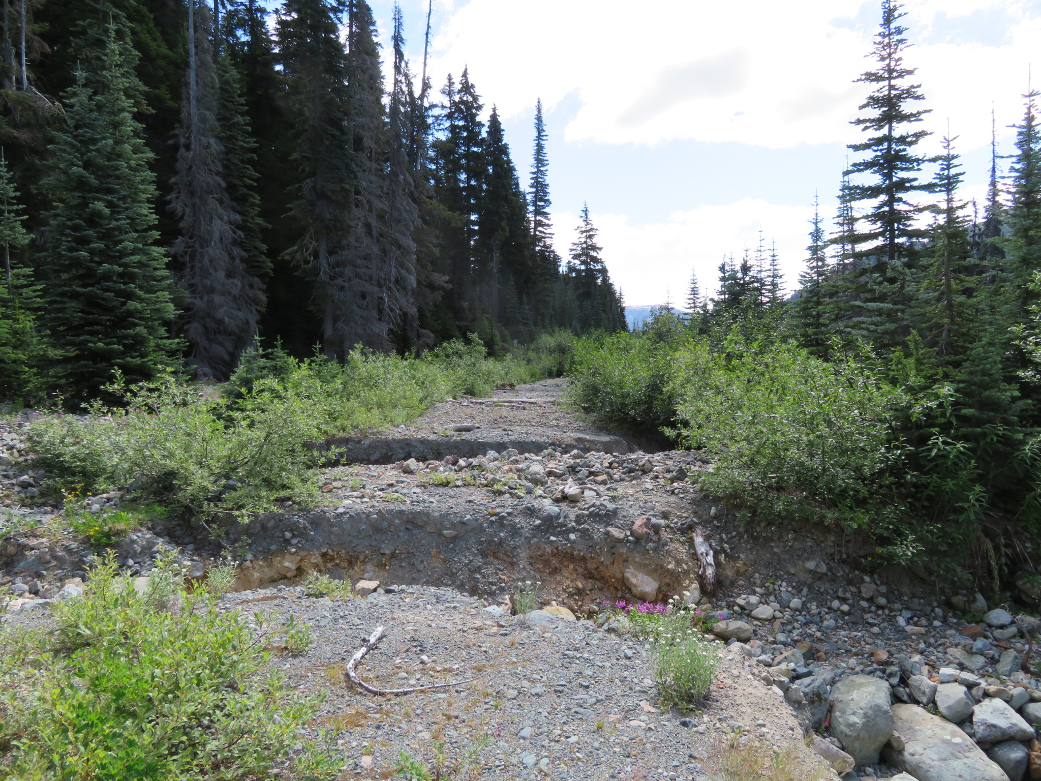
Further down there was some active roadside logging but looks like everybody was done for the weekend. It will surprise you how far into the wilderness roads are built, mines are carved and trees are cut.
higher than life, the coastal range towers above the valley floors and reminds me that there is still a long way to go
Past the mine I found a cabin to stay at. British Columbia is full of these, maintained by ski clubs, snowmobilers or anybody. The place had just been repaired after being trashed by a bear last year.
A short push up an old mining road leads to Sweeney mountain, excellent views of the surrounding peaks and the Thasta reach, where I will be paddling.
the view from Mount Sweeney
Not the only one who's having a bad-hair day!
Took a while to make friends with those two
From here, Thatsa reach stretches to the mountains. It is part of the Nechako reservoir, which when it was built in the 50's was the largest in the world. Twice I had been warned about the prevailing headwinds and seeing the water did not look promising. I had also never used the raft and had been on a canoe only few times. Not to mention the frigging bike overtaking the bow making the whole things unstable.
Thatsa Reach and the wind from hell!
in a desperate move to keep my camp bear safe, I gathered as many huckleberries from the surrounding bushes as I could!
I woke at 2 and 3 but the winds didnt die down till 4. Some more fiddling and the bike was on. Progress was slow, the water was cold and the wind was tough. By noon it was calm and by 4 it was impossible to paddle. I set up camp on one of the few spots by the shore.
I didn't realize the paddle was upside down until the next day
later it was calm enough to fiddle with the camera!
In the cacophony of getting ready for the Canol trip, this trip and rowing across the darien in 3 days, I quickly grabbed a camera. It is a high zoom canon, not nearly as good as the half as cheap panasonic I had in 2014 or the EOSm given to me by Sarah and Jason in death valley but it was alright. With that being said, it has high zoom and shoots good video, what else do you need?
a pretty unremarkable piece of wood. Nearly all of the shores are covered in those, making landing very difficult
Out in the dark and with almost no wind the paddle was a breeze. I was taking direct line shortcuts across bays and not worrying as much about my inflatable boat.

it's a miracle that nothing had fallen yet!
I was still expecting somebody to be stationed at the water intake but all that was there was that and two small shacks and three cameras. Plan B was a road shown on the map which loops around the mountains to the power station on the other side.
It started out great, there seemed to be old ATV tracks but some sections suggested that no motorized vehicles had been through for a while. The first 30km were great, well surfaced and bridges were present.
After an epic quest and an endless battle against auto focus, I give up. Canon, you suck!
Moose were also present!
and this is the bike, a great deal used but a little too small for me. Big thanks to Robin at Blackburn Design who hooked me up with new set of bags and cages. The packraft sits on the back... oh man, i like bridghes.
But it soon became evident that it would not be that easy. I spent two hours fighting with the bushes to find a big washout. After an unsuccessful attempt at controlled descent, I took 4 trips to bring the gear and bike back up. What's plan C? Give up and spend 4 days backtracking? A lot could happen in 25 kilometers, even if one of the bridges over creeks is missing it would be impossible to cross. I left the bike at a particularly tough section and continued on foot in hopes of finding water.
I would say crossing this washout was the point of no return. I would literally have to climb on all 4's and rope-pull the bike back up.
(hit play)
Two hours later I had full bottles and a flat spot to camp at a rock quarry. The road was not promising but there was a chance.
After a kilometer of hiking in the morning I found a bridge. I wondered if I would have tried to cross on those logs otherwise... and it scares me to think that I probably would.
2 hours to the bike and another two to where my other gear was. There is no turning back now. it was a small game trail on the bottom that kept me moving but plants were cutting my legs, sticks poking my eyes and bushes sticking to the bike. Other times I would get on and ride, lifting branches over my head with one hand and steering with the other, I would move a foot forward and step on a small tree to get it under the tires and keep going until eventually I get strangled by plants or come to a complete stop.
Most of my gear was on my backpack, leaving the bike lighter for carrying over obstacles. Sometimes I was able to ride but most time was spent going over, under and in between deadfall. Some impassable combinations had me going off trail or following the river (both of which required scouting on foot). Return time would be 5.5 days considering I will have to relay bike and gear back uphill over everything.
Every 5-10 meters in some sections. Not kidding
But after the last river and the last bit of deadfall I had made it and Kemano was just few kilometers of pavement away.
From what I was told it's a power station few kilometers into the mountain, it draws water from the reservoir over 790m vertical drop via 16 kilometer aqueduct. Most of the power is used to power the aluminum smelter in Kitimat and the last 15% powers all towns from Prince Rupert to Houston. I chatted with Gres, who back in the day had put the kilometer signs on the road I took. He asked his supervisor if visiting the power plant is possible.
It wasnt. No visitors, no photos, I am not even supposed to be here, I'd also have to row across the bay to camp. Gres also told me about tides and that it would be tough to go against them. I managed to get the charts from a boat and went off...
Unlike Kemano power plant, across the bay, Kemano village had its doors open. Some of them literally open and entire cabins trashed by what I assume is bears.

These should keep the grizzlies away
Gres gave me some dried mushrooms and snacks for the road. I was already down to barely 4 days of food.
In the morning I realized that rafting the ocean with an inflatable raft, no life vest and a bike strapped on top may not be the brightest idea. From 4am to 10am I was going with the tide but was being thrown around by the wind and the waves. Every 10-15 minutes I would scoop as much as 10 liters of water from my boat. But it wasnt until the tide changed that things became impossible. I pulled over and up some rocks and bundled up in the emergency bivy. Soaked and exhausted I waited for 6 hours. If there was a low point this would be it.
up down, up down, the boat flops the bikes shakes but stays firm on the bow. I am on an inflatable rubber duckie in the ocean, pedaling like a manica to keep in once place. My arms hurt but if I stop I go back, I keep scanning the inaccessible rocky/mossy shore for anywhere where I can pull over. Who's idea it was to raft in the ocean... with a bike!
The only boat I saw all day slowed down:
"Are you okay?"
"Yeah"
I guess I am okay. I pushed the boat in and went on.
Sometimes it was okay but the wind never stopped. Around some corners I had to paddle as fast as I could to move at crawling pace.
The only place to camp was a river mouth and few bears scattered as I approached. The cabins were not quite in shape so I set up camp and set up an alarm for 3. I ended up building quite the barricade around that collapsed cabin and the entire thing swung with the wind.
With an eagle down at my bow, luck was turning up. Most of the day was good and I covered all of yesterday's distance in only 7 hours (~20km).
nope, its not the camera. that feather is huge!
From the ocean floor to ta world of snow and clouds, the coastal range is magical
the water was calm so I could shortcut across bays, just aim for the point and fight through the pain of aching muscles and empty stomach
At a bay, I saw a man on a boat and it turned out that there are also hotsprings and a cabin! The man had lived on his boat for 53 years, mostly on the west coast. This whole ocean business was turning for the best.
Calm waters and great views but my main worry was all the saltwater. Chain is already getting rusty and so are other parts. Lots of seals pop out of the water to look at me and sometimes a whale would come up for air. Day 3 on the ocean ended at another hotspring.
crazy to see the coastal clearcut blocks. Some of them so steep that there is no way a machine could get there. How were they done? How is that profitable?
golden sunset across the channel above Loretta island
With almost no food left, it was a 40km paddle to Kitimat Village. A lot of open bays but the wind was cooperating.
Across the bay was the Rio Tinto aluminum smelter, a rather imposing first sign of civilization.
But the small native village across the bay was a more welcome sight. There was no celebration or screams of hapiness, infact... i was a little disapointed that it ended so soon.
I was welcomed by a jar of salmon in salt water and you wouldnt believe how fast I munched it down. With nothing to offer back, I gave the woman my eagle down. The natives from Bella Coola give that to their friends.
There is no destination. It's all about the journey. I rolled out of town, put the bike in the ground and stared at the curve behind me - looking for the front of a pickup truck and stuck my thumb out.
Let's go to the Yukon!
Logistics
10 days
Distance: ~370km (40 lakes, 130 ocean, 200 land)
From Houston, BC to Kitimat Village, BC
Food/stores: none (snacks at Nadina Lodge ~90km from start)maps: BC backroad map and ibycus topo maps for garmin (free)
Not recommended!