
Somewhere in the Alaskan Arctic. August 30, 2014

DAY 1: THE NORTH SLOPE 53MI/85KM

The Dalton Highway, known as “The Haul Road” stretches 414 miles and its one of the two roads that crosses the Arctic Circle in North America. It was built to service and maintain the Trans-Alaska pipeline. Some 200+ trucks travel it daily to bring supplies to the Prudhoe Bay oil fields. It is the longest stretch in North America without services (244miles – although there is no grocery store for the entire length of the road.).
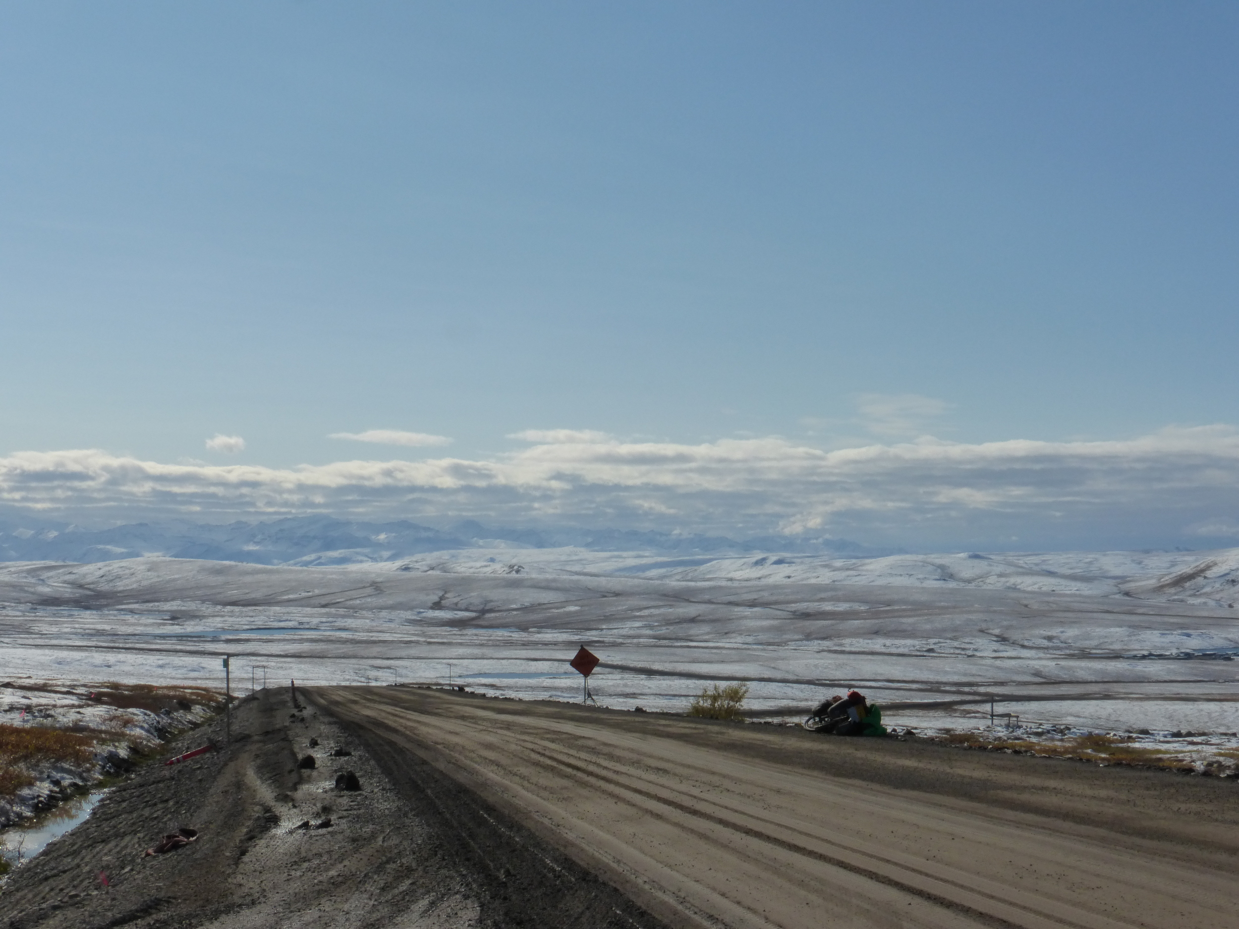
“It's up to you man, just don't die.” - the traffic control guy wasn't too happy to let me go through the 22 miles of construction. Pilot cars guide traffic for the entire stretch and I refused the offer for a ride, apparently so far up north they can't make you hop on their trucks like they do in other places. Gravel trucks paced back and forth along the construction stretch where me and the hunters slept last night.

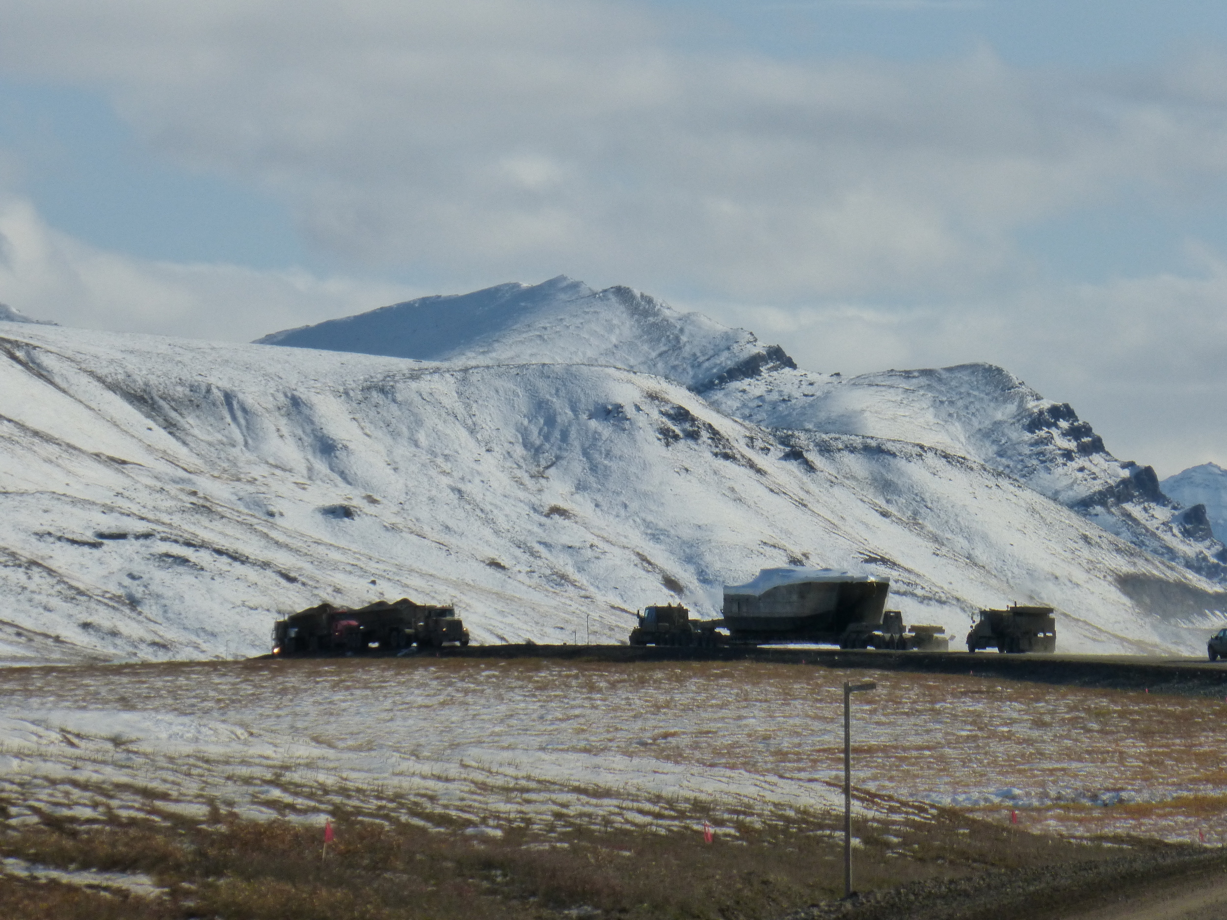
The north slope of the Brooks Range involved rolling hills, vast views and high truck traffic. In the photo below, three trucks are waiting for an oversized load to cross the road. The pilot cars could drive up to 30 minutes ahead – telling people to pull over. This particular load had one extra semi which will be pushing up the climb on Atigun Pass, too bad I didn't meet them there.
It took me well over 3 hours to clear the construction zone and I took a faint road off to the side to find a spot to camp. It was only 6pm and even though it's not summer, there are still long hours of daylight. I decided to scramble up one of the mountains, after all it looked very close.

My unmatched skills at balancing my camera on a rock, self timer and running down. This is take 2.

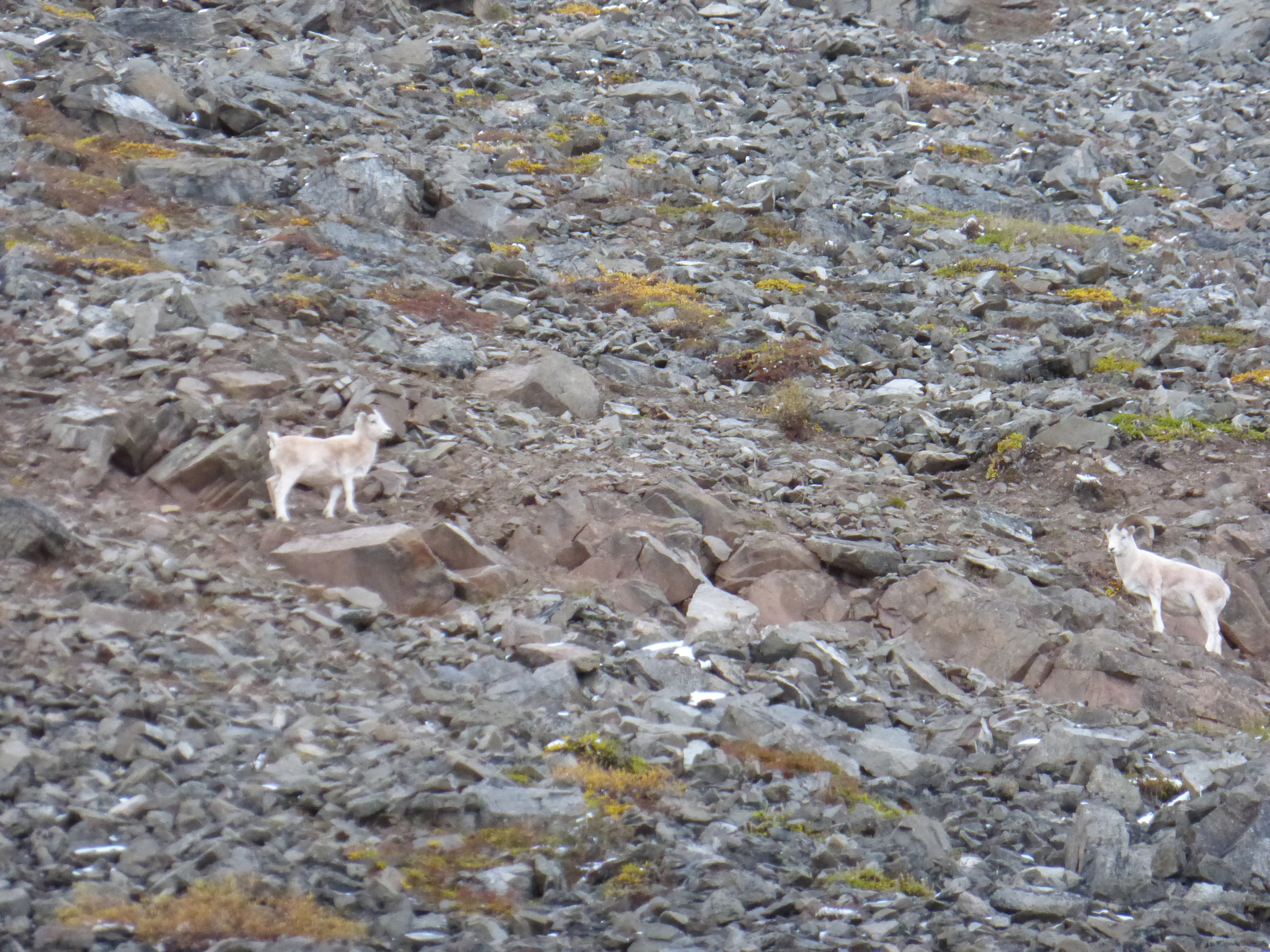
I followed those mountain goats on the way up, they must know where to go. They have been here longer than me.
I should have stopped here to eat then climb down. It has already taken me two hours and getting to the top would mean returning in the dark. To top it off, I hadn't taken my headlamp as I expected to be up and down in an hour or two.
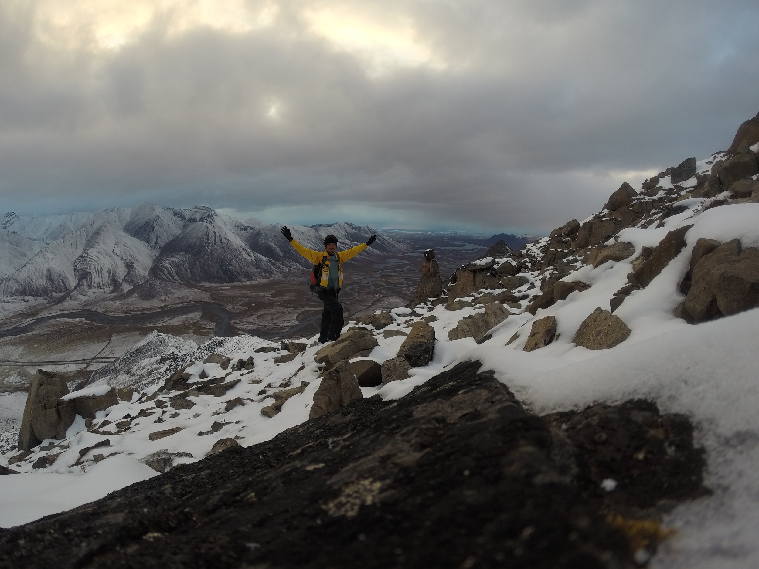
By the time I reached the top and had my dinner it was 10:30pm. Not good news, there were many steep drop offs and I may have to backtrack up again if I end up going the wrong way. There were few snowy/rocky sections which I climbed up on all fours.
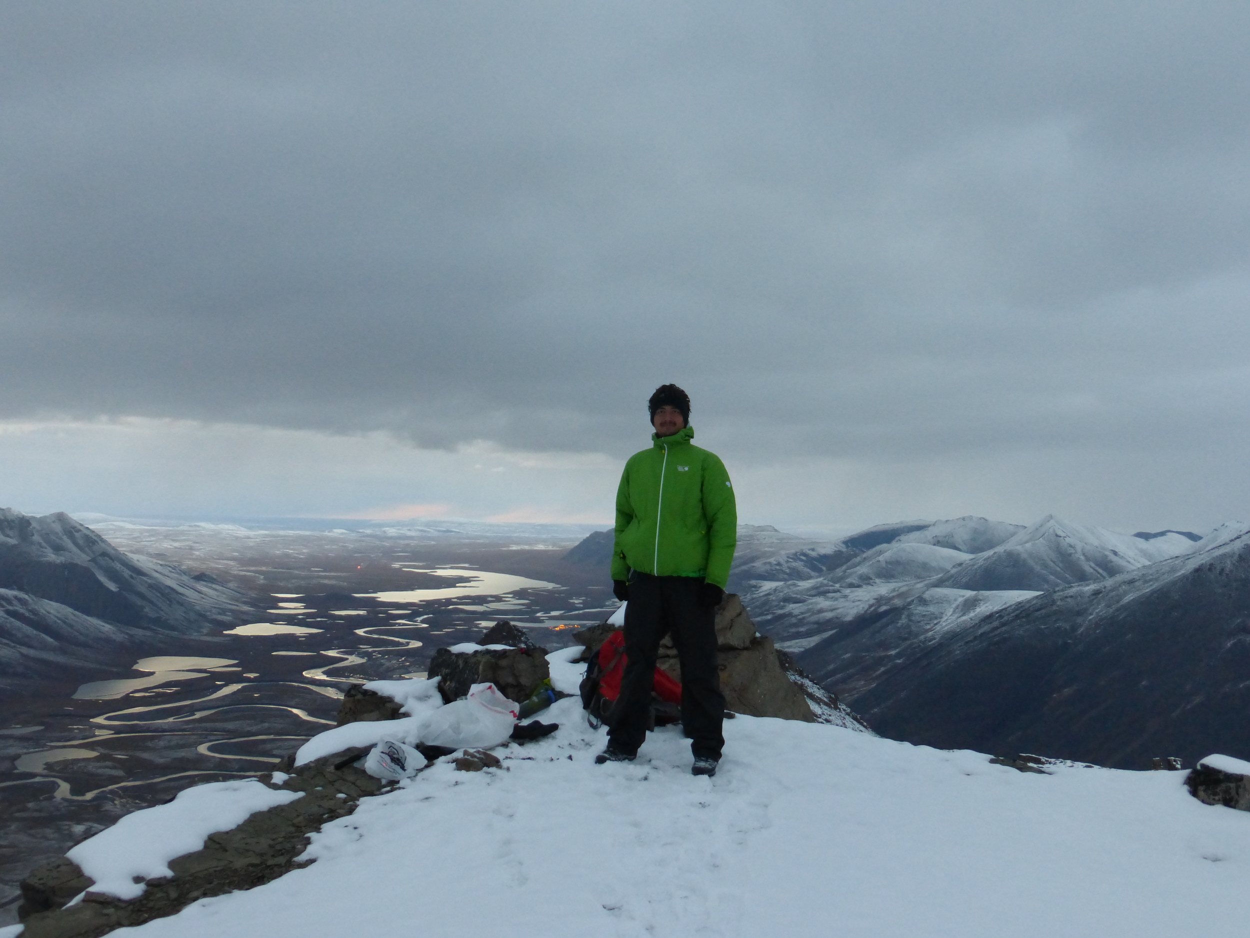
But this was definitely worth it.
(click for full size)
This is darker than it looks.

1:00 am, and I knew the time because I could only use my tablet's screen for light. After some unpleasant and at time slippery descent, I made it to the bottom only to realize that everything looks the same and I could not find my tent.
Bad place to be without a tent at night. Going in circles was hopeless, I did not know where it may be. Using camera flash wasn't much success either. I kept going downhill to the road and then found the access road I took to set up camp. On the second try I managed to find my tire tracks and my tent. 1:30am. Great way to kick off the Dalton Highway!
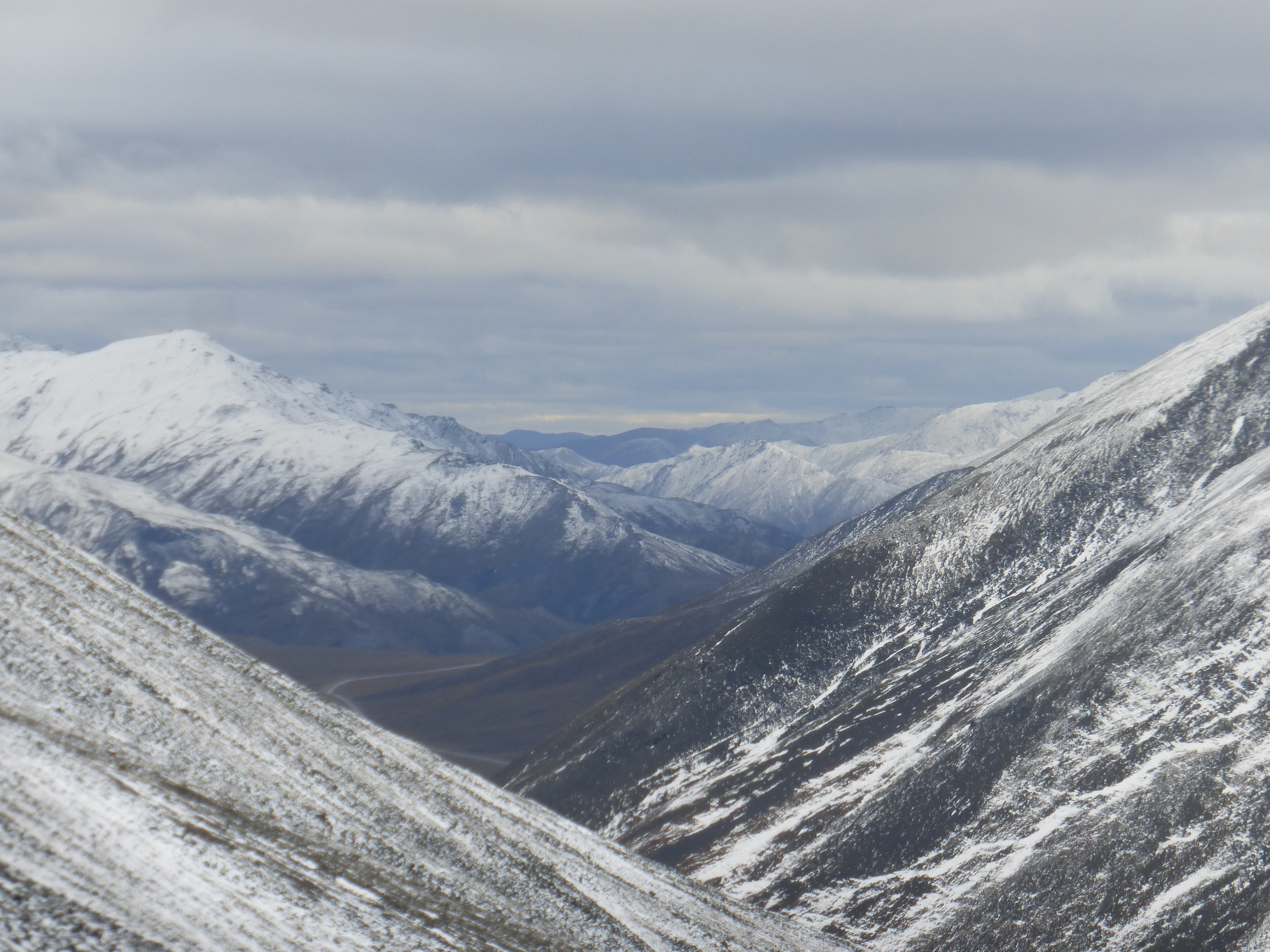
DAY 2: ATIGUN PASS 37MI/59KM

Exhausted after the 6 hour hike yesterday I got up late to find out that clouds have covered the sky, looks like it will snow. Today will be a big day – crossing Atigun Pass. At only 4700ft it's not particularly high but it's location well above the Arctic Circle makes it very unpredictable and dangerous - although I'm sure the ice road truckers tv show makes it more dramatic than it actually is.
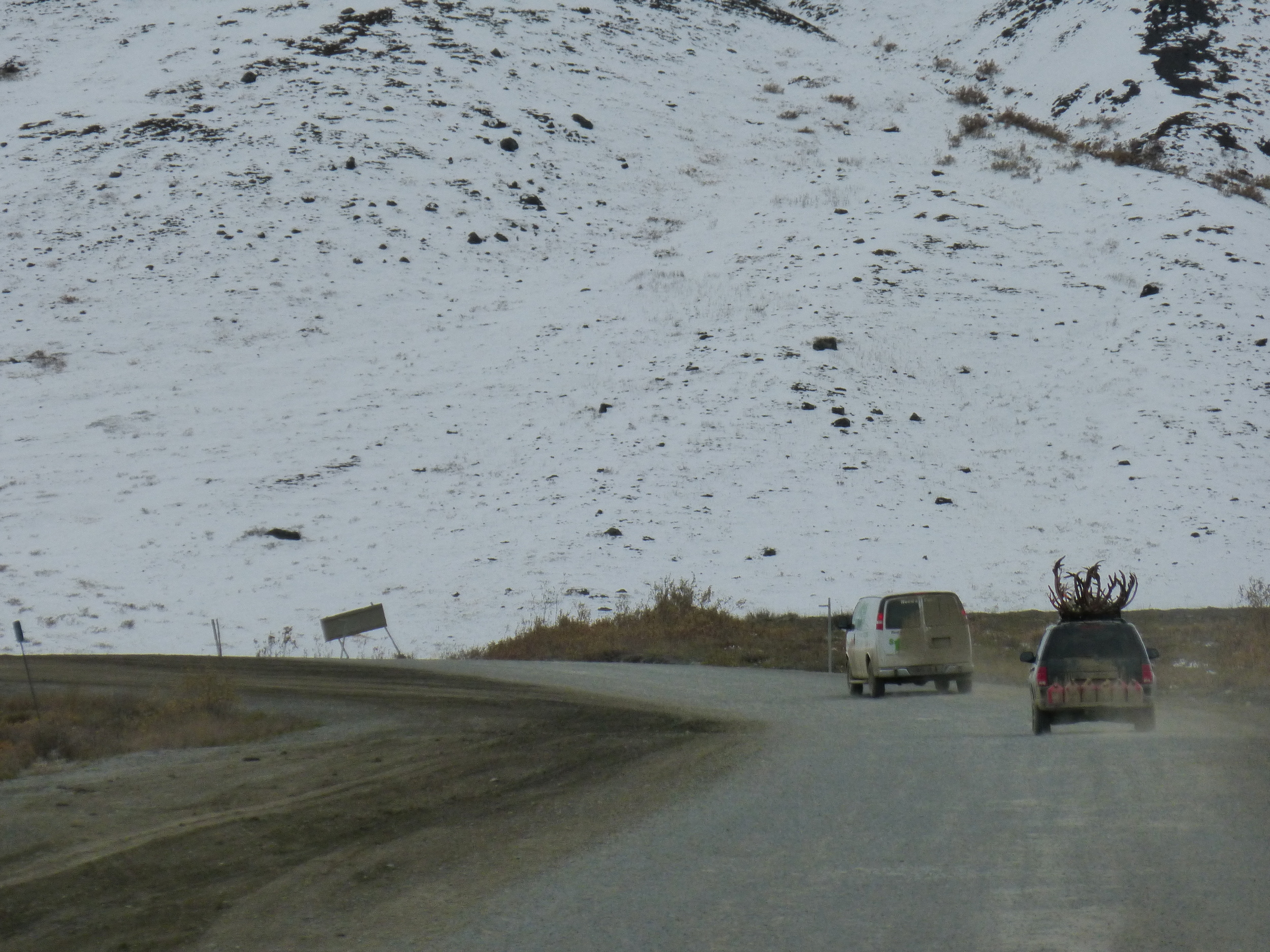
Hunters here are sure to display their trophies on the way back (not that putting those antlers inside is really an option).
It started snowing as I made my way up.

But I was surely enjoying it. I've got my “crazy hair” out, fender on the front rack (due to mud) and wearing my shorts! Granny gear of course. There's nothing a good attitude can't beat, many a cyclist would complain about this.

You should see one of those things coming down, it's amazing. Just loud DUM, DUM, DUM… Then they look at me like I'm a crazy person, I wave and smile.

Going up the endless, white oblivion.

After stopping to take some pictures and being unable to start pedaling again on the snow, I heroically pushed the last few hundred meters to the top. There was no sign proclaiming the Atigin Pass, or the elevation. But there was a long downhill with my name written on it.

And the road ahead. I was actually moving faster than some of the trucks going down, yay!
At the bottom I found a bunch of trucks waiting, apparently they radio each other and convoy one-way across the pass, to avoid having cross-traffic up there. I challenged one of the truckers for a race, on the condition that he goes backwards so it's fair.
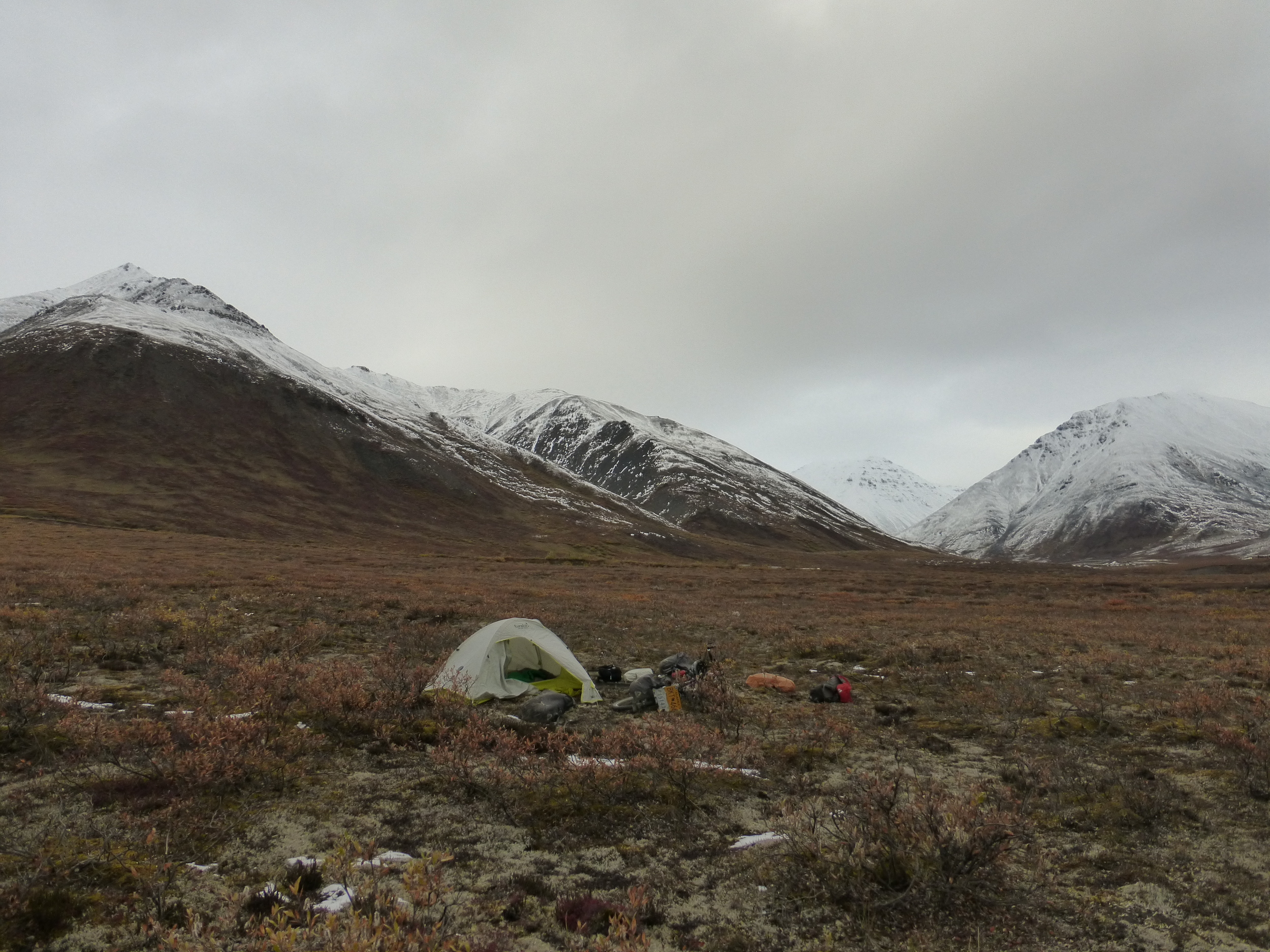
I've now heard rumors of the Coldfoot trucker stop dinner buffet and I planned to make it just in time for dinner tomorrow. That meant stopping earlier, so I set up my tent up in the tundra.
After I went to wash my pot in the river across the road, a car passed me and then stopped down the road. I don't think they saw my tent. I wonder what they were saying
“Um… there is a guy in the mountains carrying a pot. Should we stop?”
"No honey, don't disturb the wildlife."
The car drove off.
DAY 3: SURPRISE! 54MI/87KM
Apparently I was enjoying the snow drizzle too much yesterday. It was time for the real deal.

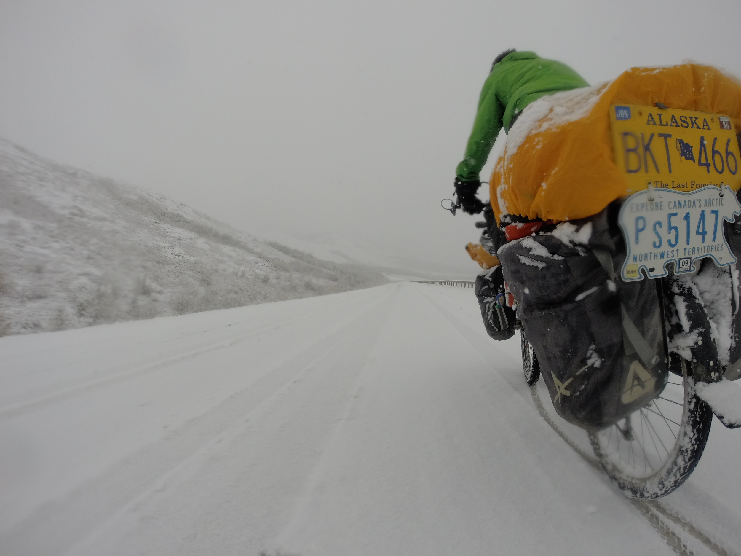
I made my way downhill and my brakes did not agree with the snow, I had to put one, sometimes two feet down to move at a safe pace. In this shining example of Bicycle Safety, I am actually holding my camera with one hand, a foot on the ground to slow down my descent and the other hand barely keeping the bike going straight.

It was just like back on the ice road!

And I was having the time of my life. Traffic has stopped, there was only one truck earlier and two pickups who stopped to check if I am ok, they said they had chains for Atigun Pass. Being back up there would have been fun!
Anarchy in Alaska… or maybe it was the hippies! (see the stump?)

I later saw two people beside the road, getting ready to what it seemed to be a hiking trip. Good to know there are other crazy people here, it seemed that they were enjoying the storm too. Sarah and Shawn were doing research involving the evergreens up here, they were getting ready to cross some rivers up to their plot.
The ice road turned to slush road, and then to mud road. It was raining and the new pair of Columbia gloves that I got at Fairbanks – tagged as “Waterproof” were not. I was now riding with 70$ sponges on my hands, making a fist and trying not to freeze.

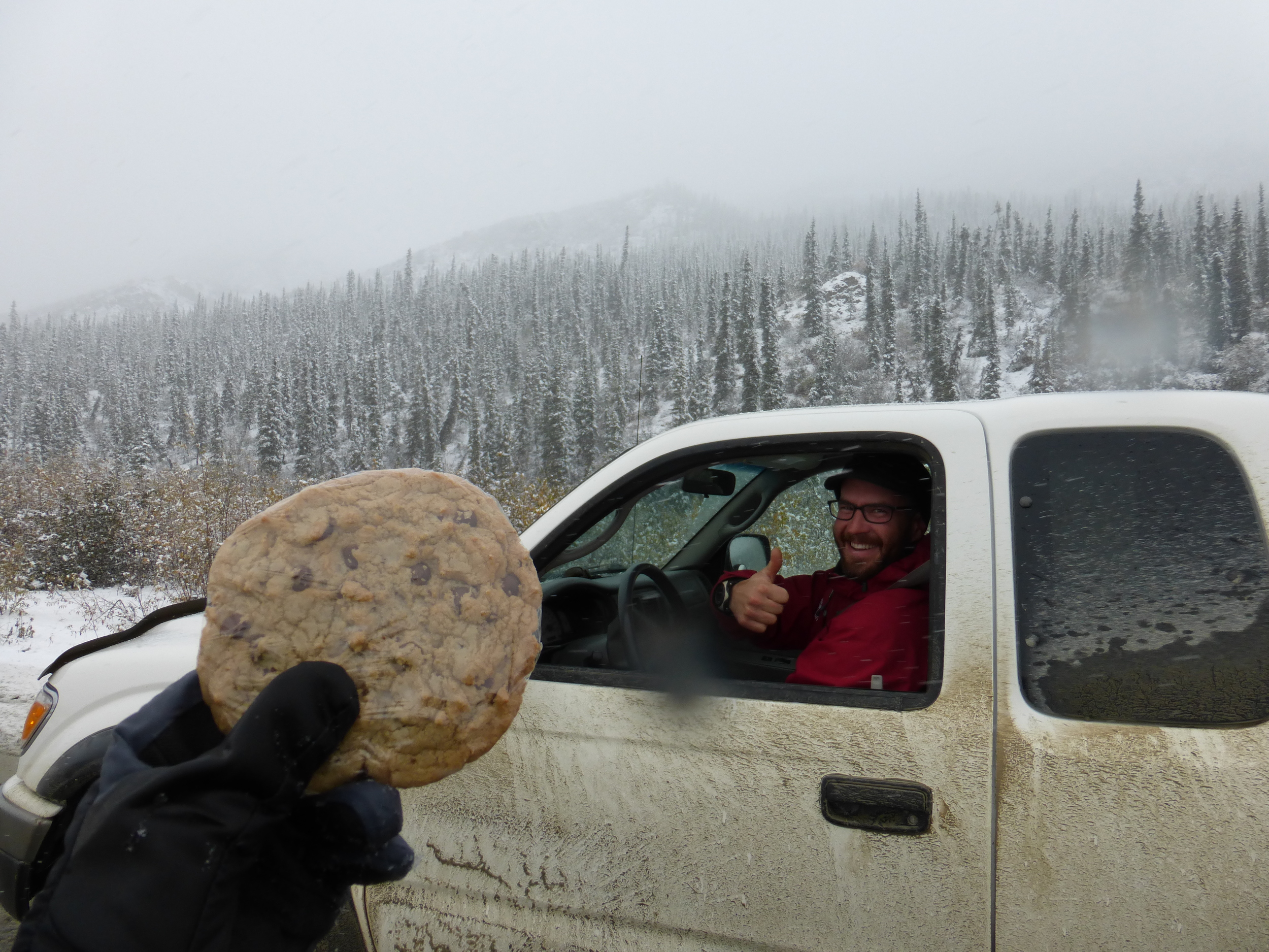
A jumbo cookie turned the odds in my favor.
I turned around to see a grizzly with two cubs looking curiously at me, pacing back and forth along the pipeline access road beside the highway.
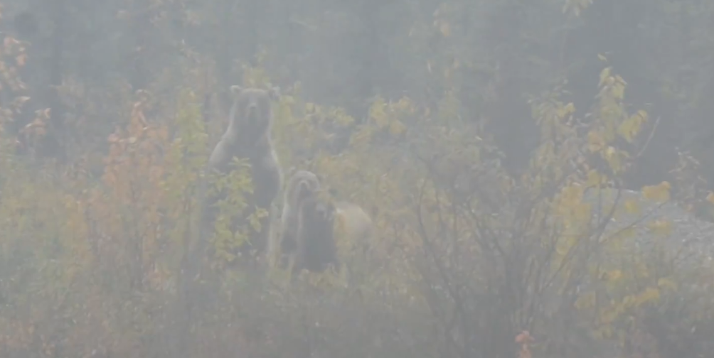
They saw me too!

I made it to the dinner buffet at 6pm. Aside from a giant cookie that a guy gave me and some crackers that Sarah and Shawn stocked me up with, I had no food since the morning. The lunch buffet was epic, I highly suggest any cyclists (or non-cyclists) to plan their trip itinerary around arriving at Coldfoot in dinner time. I sat and ate for four hours. Ribs, Chicken, sides and salads. Refillable drinks and even dessert! At 10:30pm I realized that I am not going anywhere and slowly rolled out of town to find an overgrown dirt road where I pitched my tent.
DAY 4: HEADWIND 27MI/43KM

Years ago when I used to train for swimming competitions, sometimes we would use long rubber ropes (think big scale elastic bands) and swim to the opposing side of the pool using lots of energy and then stop and get pulled back.
This is what today was like, except I was on the road and there was no rest period or going back. HEADWIND! The Uphills were just ridiculous and downhills required pedaling. Not even the music blasting through my headphones could dampen the deafening sound of the wind.

Some 30 miles later, I decided to take a “headwind enforced” rest day. It felt like I was wasting all that good energy from yesterday's feeding frenzy.

I set up beside the pipeline just as a squall rolled overhead.

DAY 5: AWAY FROM THE ARCTIC 49MI/79KM

The clouds and headwind were gone, and unfortunately so were the mountains. From here is rolling hill terrain all the way to Fairbanks.

Happy as an Otter, after an obligatory shot at the Arctic Circle sign…

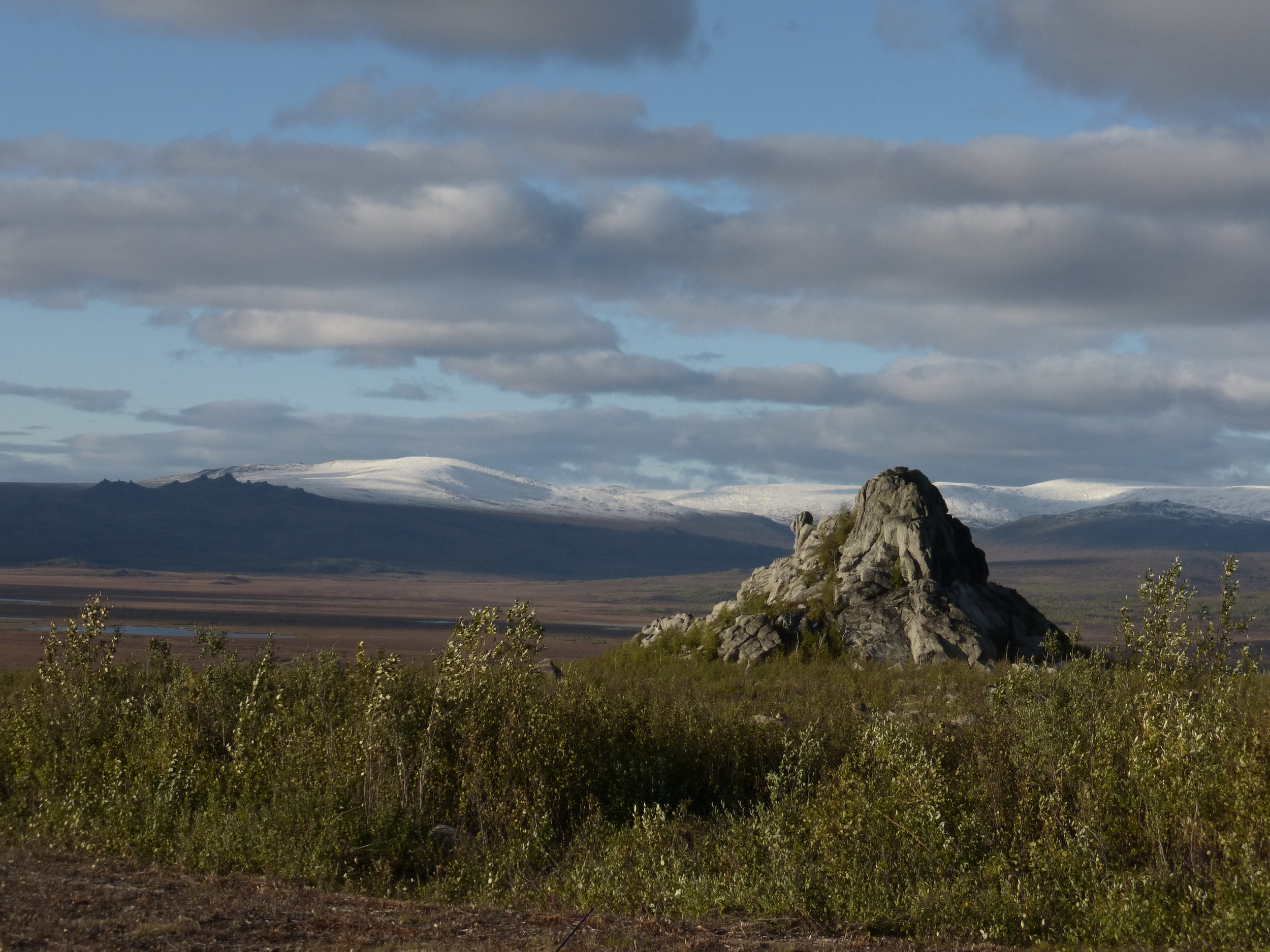
...I made my way past some cool rocks…
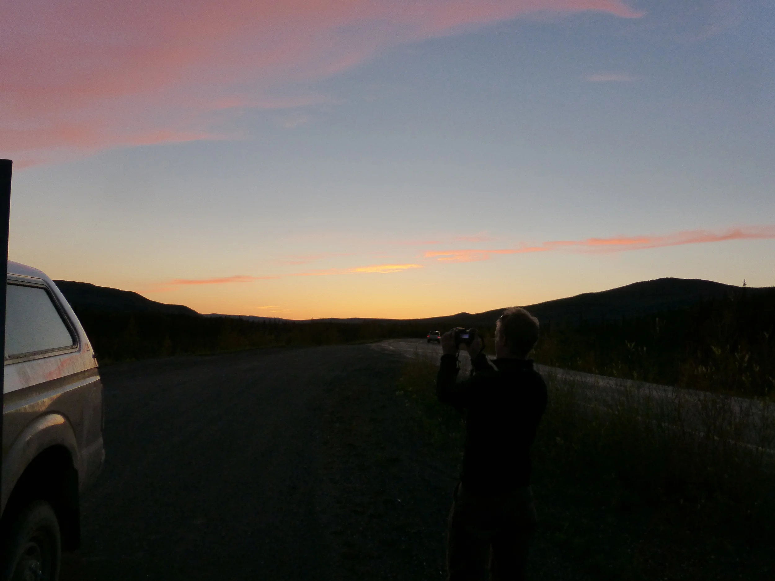
...and set up camp to see the setting sun…

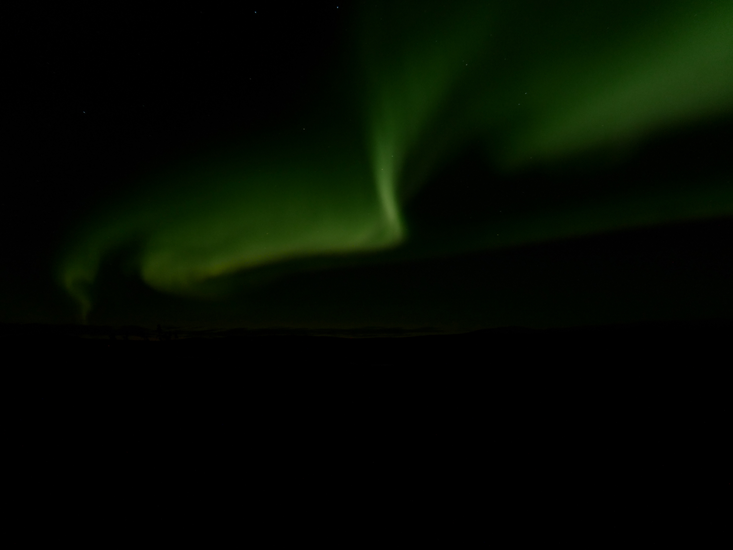
...and of course – the Northern Lights.
DAY 6: YUKON RIVER 43MI/69KM

The road was dusty, the hills were brutal but hey! There were NO MOSQUITOES or other biting insects. The only time I ever had to deal with them was one day on the ALCAN. I've heard stories about swarms and swarms of flies, I really shouldn't be complaining! Granny gear up the hills and full brakes on, going downhill.
There is indeed another road which runs right beside the Trans-Alaska pipeline, following it would be a cool idea. But one would need to obtain special permission from the oil companies.

When somebody told me that there are 200+ trucks per day I did not believe it. But they were right. I don't have scary stories, close calls or mean truckers. In fact they were all very nice – leaving more than enough space when passing me (even that huge boat load on DAY 1) and even coming to a complete stop when there is a truck in the opposite direction. The road itself was well graded and maintained too.
Haul Road Truckers: You Rock!
I got to a small camp by the Yukon River, and if you have been following my blog you could tell that I do not have the best decision making skills. Regardless, I accepted the offer of a drunk man for a boat ride.

Dear readers, I have never been on a motor boat. “Yukon Jeremy” made sure to scare the living crap out of me by getting as close as possible to the river bank at high speed, grabbing his gun on the way back (although he let me shoot it! first time shooting a gun) and playing chicken with the support beam of the bridge over the Yukon river. Drinking whiskey and jim beam with him, but I did have some assurance as I left my bike with his friends.
Still in one piece, still drunk and with my ears still ringing from shooting that gun I got back on the Dalton Highway. There was a pickup ahead of me which suddenly stopped.

It was Sarah and Shawn. Throughout the day I have been entertaining the idea of skipping ahead to Denali National Park and riding it, instead of the fairly boring terrain between here and the park.
At the time I felt that I really needed an excuse for taking the ride with them but in retrospect: who cares!
I bet Shawn's photo is much better, nobody is standing in his way!
DAY 7: DENALI, NOW WHAT?
I stayed with them for the night and next day they drove out to Denali National Park. I also found out that one of the hunters that took me up north was a colleague of Sarah. Small world up here!
(I learned later that the hunters successfully brought back few caribou)

Up next: the 90 mile Denali Park Road!
and until then, have a look at this amazing time-lapse video Sarah made of the life in the Brooks Range: