
Delta Junction, Alaska. 24 August, 2014
route
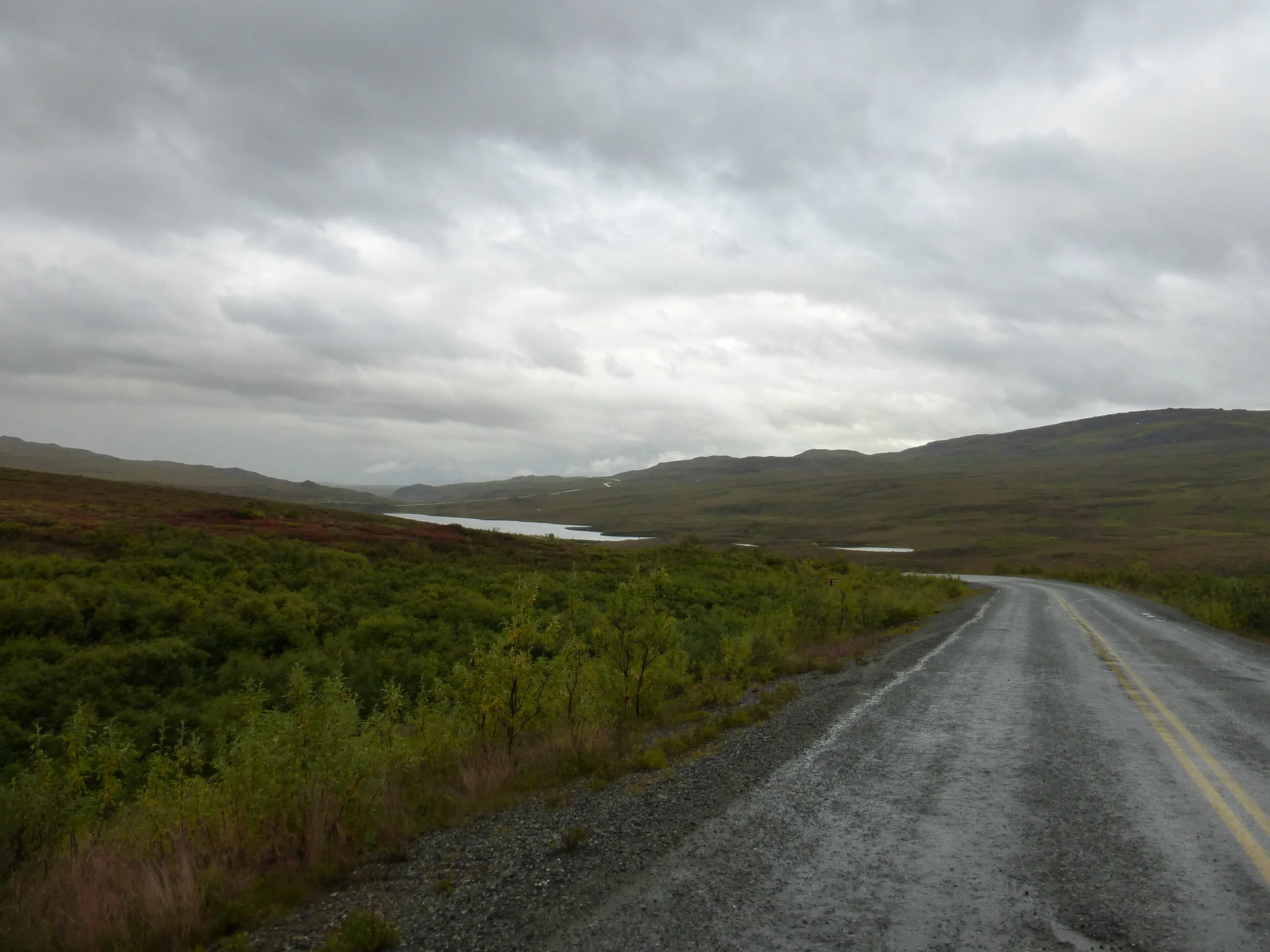
DAY 1 59MI/95KM
There are 3 reasons people go to Alaska. the oil industry, the freedom or The Military - the first 20 miles were alongside military property, shooting in the distance, explosions and helicopters.
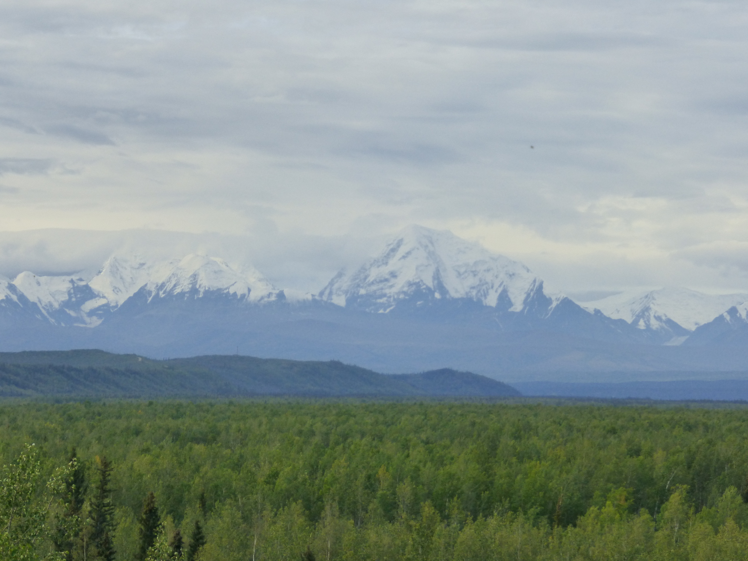
Fort Greely and the mountains
Good to know they aren't shooting my direction!
The headwind was bad, it would have been tailwind if I were headed to Fairbanks but I still had to get to the mountains, even if they are covered in clouds.

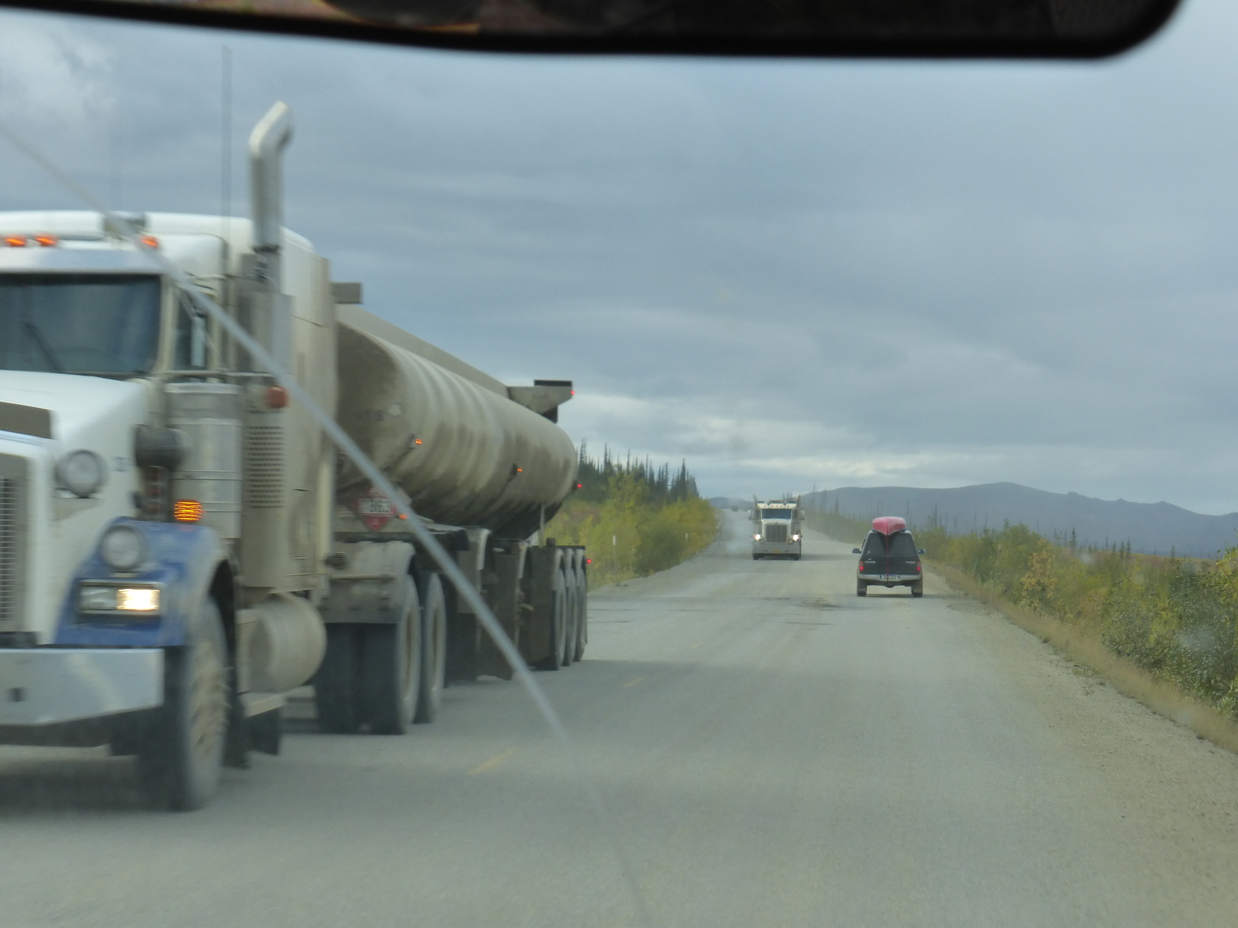
At the crest of a hill I had my closest call with traffic. Two trucks from each way on a shoulderless road. I've gone into the habit to check rear view mirror when a truck in the opposing traffic approaches and this time it paid off. I rode down the steep gravel bank to avoid the truck behind me.
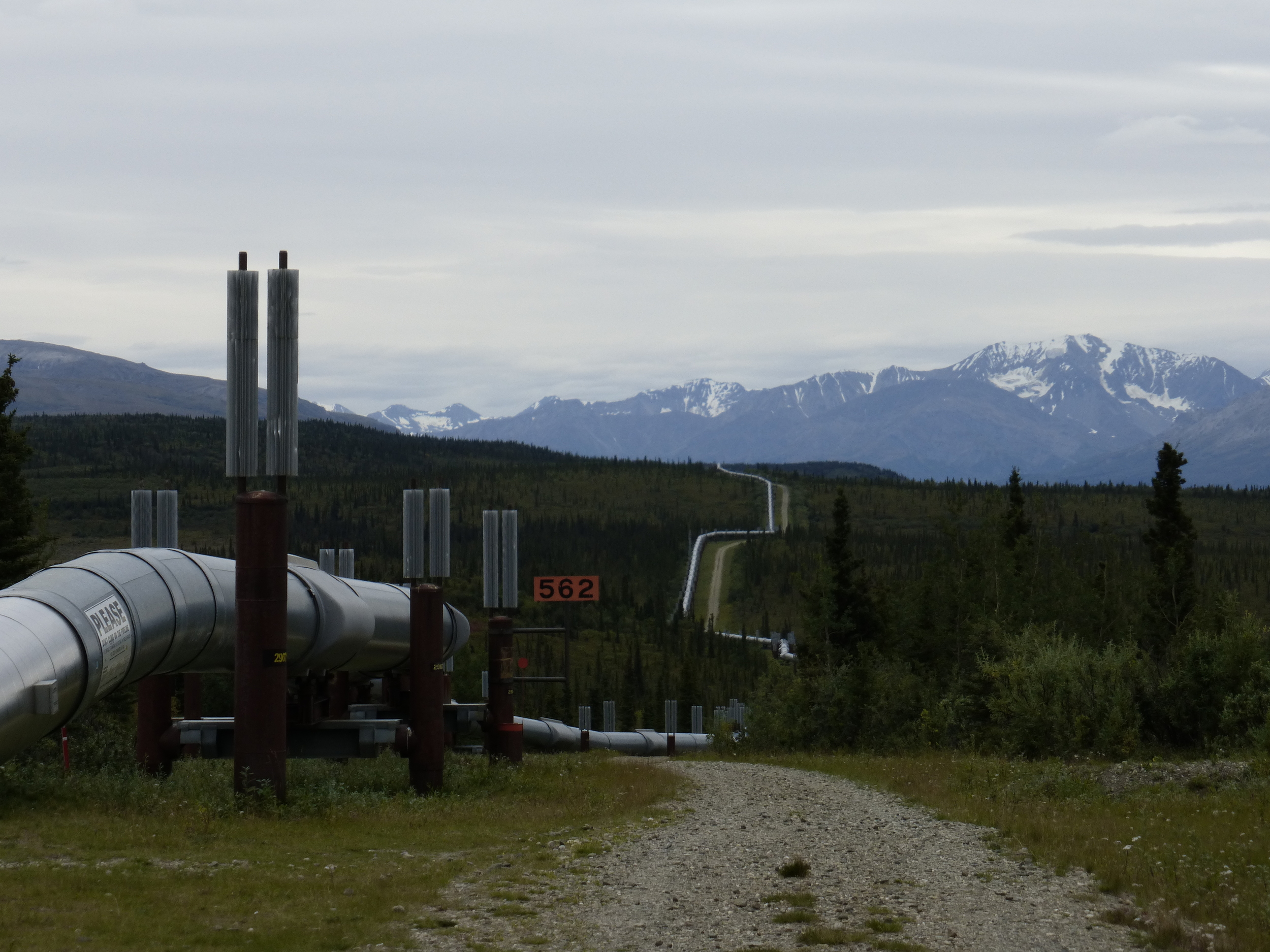
The Trans-Alaska Pipeline. 12 pump stations and 800 miles of liquid gold. The pipeline moves oil from the oilfields in Prudhoe Bay to Valzez, crossing some extremely remote and difficult terrain. The zig-zagging design accommodates for temperature-related expansion and contraction, as well as more protection during earthquakes, also makes the pipeline more photogenic, thank you!
The small sign there reads: "PLEASE, don't climb on the pipeline. It's difficult to maintain your footing on these surfaces and you could be injured in a fall." It's obvious that the oil companies care a lot about your well-being!

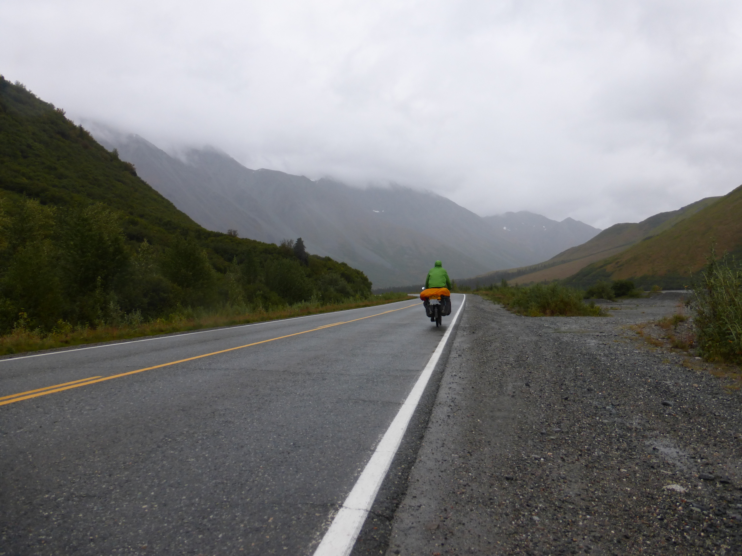
When it started raining, the wind eased up. I rode into the misty mountains until I found a nice pull-out, far from the road and pitched my tent.
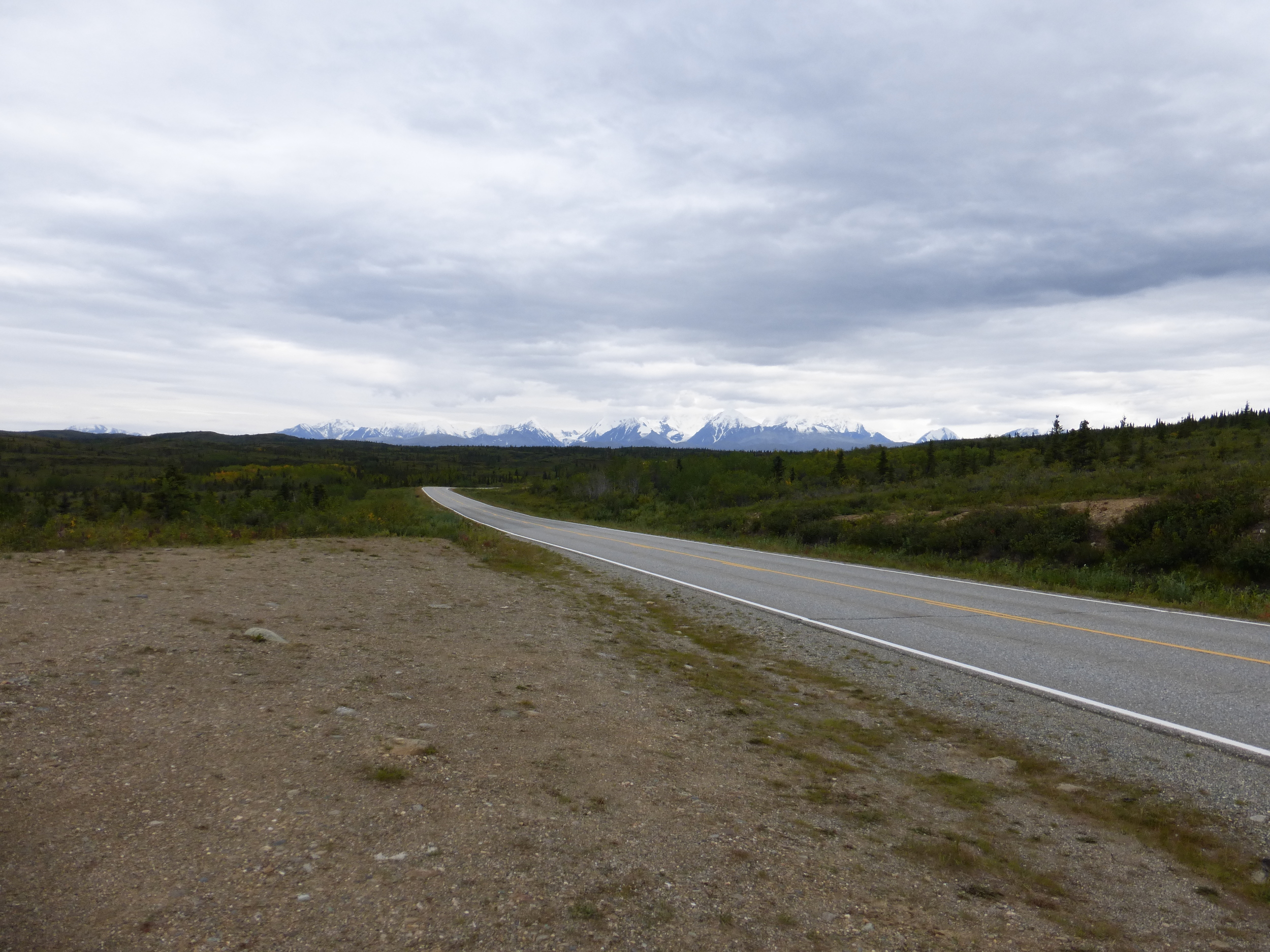
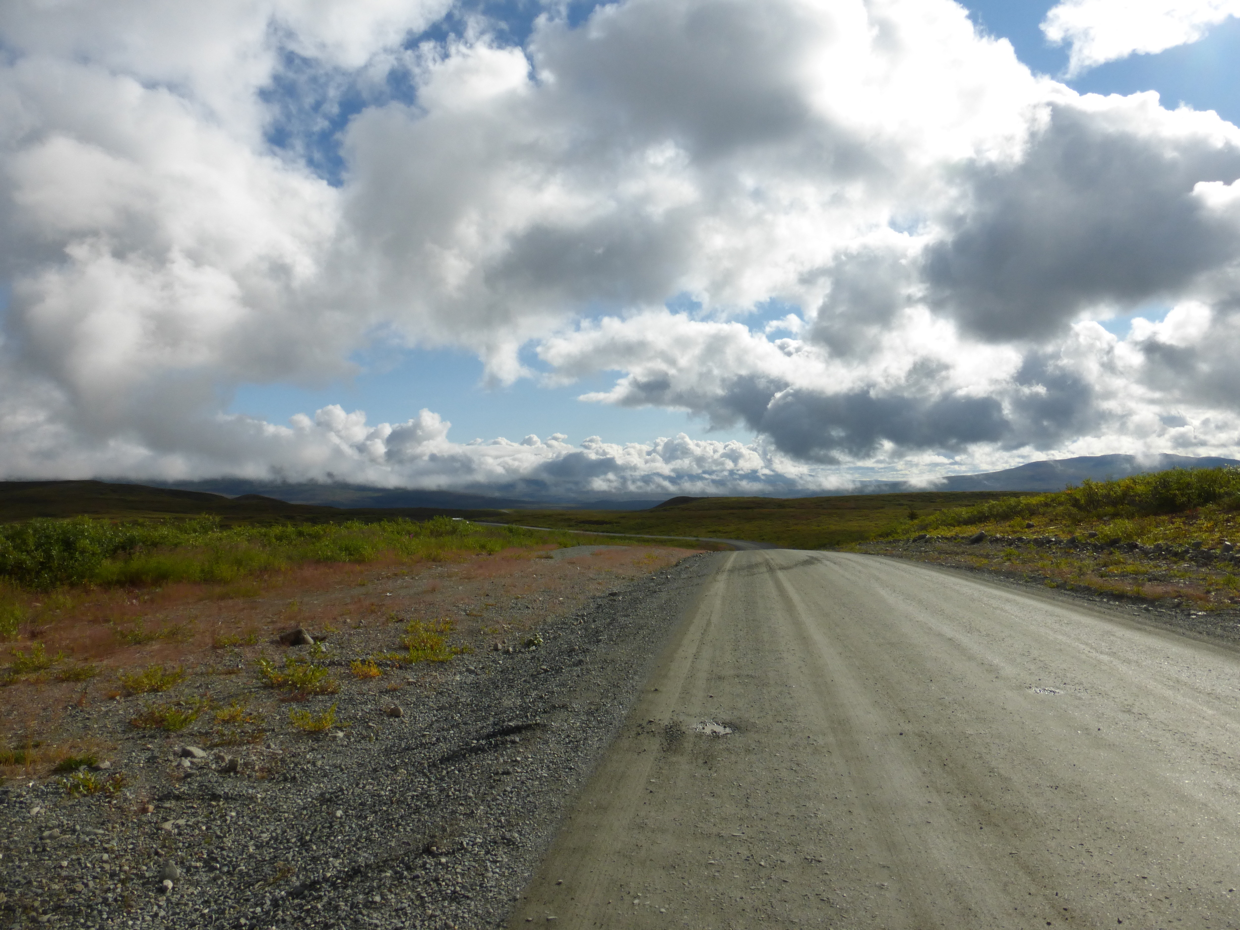
DAY 2: DENALI HIGHWAY 42MI/68KM

I met a man about to head out to hunt, he asked me where I'm from and seemed very upset that he didn't know where Bulgaria is. He headed off to hunt and I headed off to cycle in the rain. Maybe I should have asked to join him for the day? I hope he doesn't catch a moose, it would be hard to carry that in a backpack.

Paxon Hotel, the man who offered me his cabin yesterday said to drop by and say hi. But there is nothing, the hotel/restaurant has long closed leaving boarded up old buildings. Through the clouds I got a glimpse of the Wrangell Mountains - the second tallest range in Alaska.

Finally: Denali Highway
The climb in the rain up the 20km of pavement before the dirt begins was slow, I utilized my granny gear, although I call it “Don't be a Hero Gear”. At the top I saw two cyclists struggling up a hill, when they reached me we exchanged few words but they seemed in a rush and they didn't look too happy (maybe it was all that rain!)

Dreams and hopes of sunshine and blue skies, but not today.

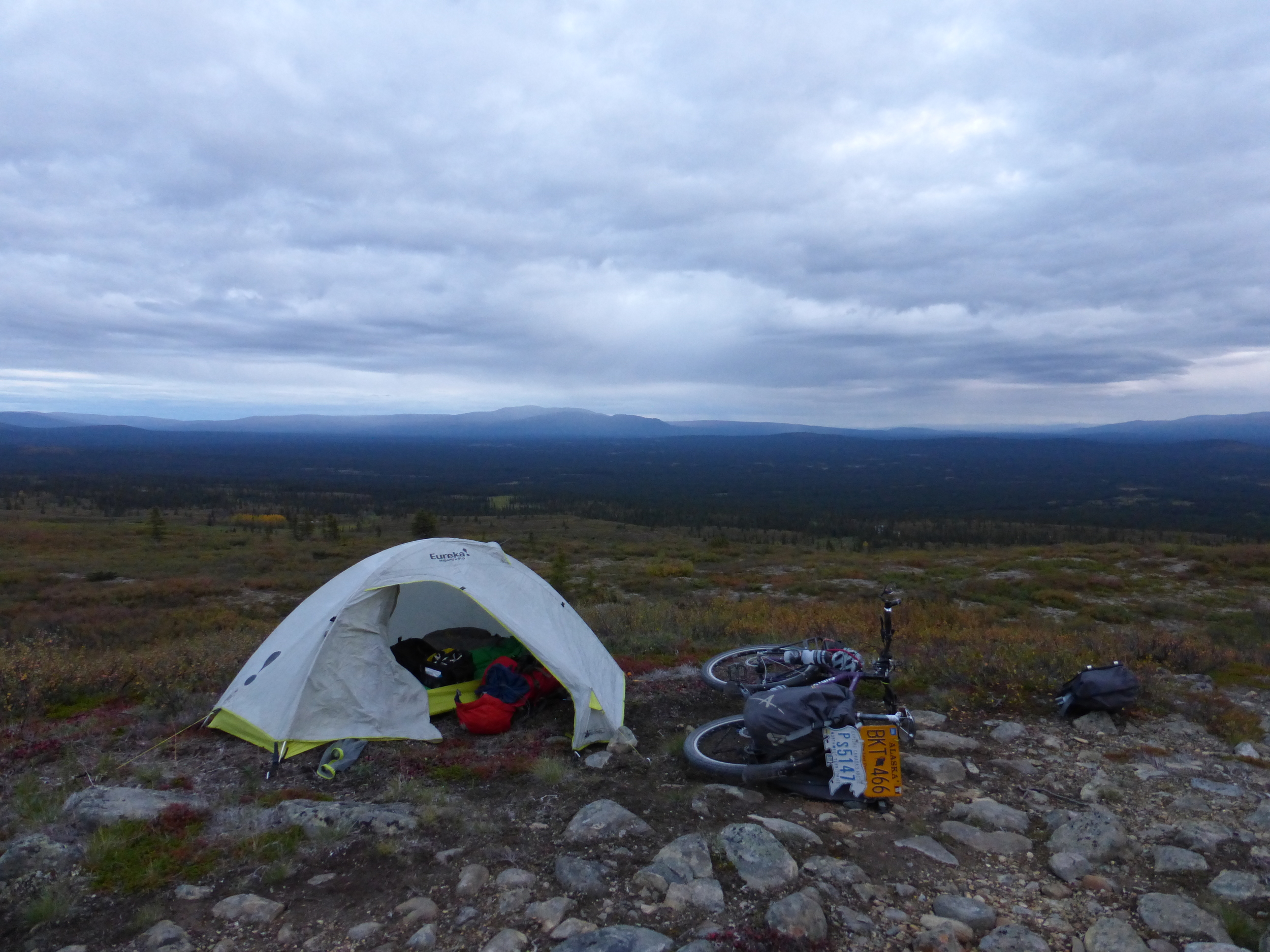
I got a glimpse of the setting sun through the clouds, the road turned to gravel and the fading daylight reminded me that I need to find a place to sleep. No motels, no campgrounds, just a level spot in the tundra near the road.

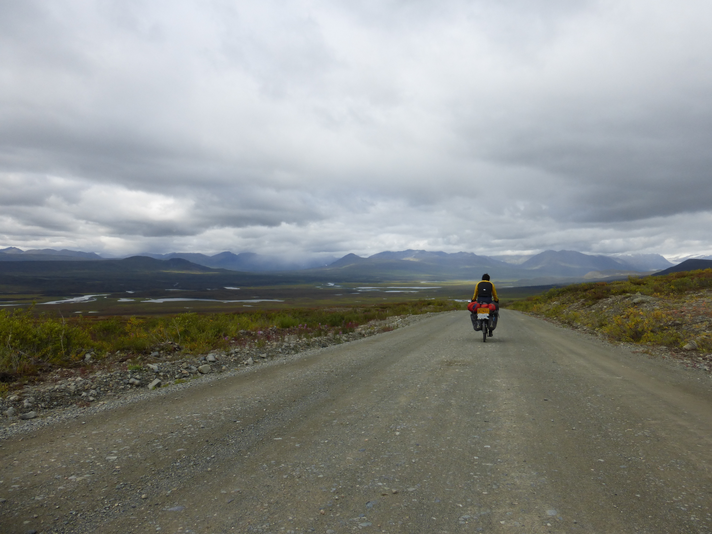
DAY 3 53MI/85KM
Even though I saw some blue skies, the Alaska Range to the north was hidden in clouds. I could barely see the snow capped mountains and massive glaciers in the distance.
I stopped at a dog kennel beside the road, some thirty dogs and thirty little boxes, thirty chains holding the dogs and most likely thirty harnesses hanging nearby. The dogs were excited to see a visitor and in all the turmoil of barking a man came down on an ATV from the cabin from the top of a hill. He lives here and takes on rescue dogs and between work and giving tours in winter he also races. The Iditarod came to mind but he did not like it much because of all the media – he is racing the Yukon Gold this winter. The dogs train pulling ATV in the summer and the sight of one sent them into a barking/howling frenzy.
Among the excitement, I only managed to take one photo, below.

Part of the Denali Highway was built on Eskers. During the ice age, this entire plateau was filled with glaciers, glacial rivers flowed through and deposited grit and sand. When the glaciers melted away, they left a narrow hill in the middle of the plateau.


I saw a great spot beside the road but it was fairly close to an RV. I went to ask them if they are okay with me camping there.
“Sure, if you don't mind shooting.”
A family from Anchorage was here hunting for Caribou, while talking a young man came out with the RV carrying two holstered handguns. Wow people here mean business!!!
DAY 4 38MI/61KM

Unfortunately I have not seen much of the mountains since Delta Junction and it didn't look like today was going to be the day either. Gear was getting wet, my gloves were certainly not waterproof even though the tag says so, rain gear starts to fail after about 3-4 hours but normally by then you are soaked already from climbing hills. Cold and miserable. The sound of mud and grit grinding with the chain and the raindrops hitting my hood were all that I could hear. I wasn't liking this.

After cresting a hill, I looked back to see the most amazing and magical view. This is what I came for! Shades of red and green and orange, the cloud covered mountains... oh why bother, just look at the picture.
DAY 5 23MI/37KM

A short, mostly downhill ride on muddy surface and finally pavement took me to Cantwell. I really didn't have a set in stone plan for Alaska but a quick look through distances on google maps brought me back to reality. If I wanted to do all the things I want to, I will need to compromise. A hike in Denali, riding the McCarthy road in Wrangell wilderness, the Dalton Highway and what about the Kenai Peninsula?
I had convinced myself that I didn't need to go up to the Dalton Highway – as I've already done the ice roads on the Canadian side. Besides, the oil companies will not let you ride the last 8miles from the ocean here in Alaska.
It's just 650 miles to the top, oh well… why not! I parked my bike beside the road and stuck my thumb out. I didn't have to wait two days like I did in the Yukon. The first car that passed picked me up. (it was a pickup obviously – this is Alaska)

Glenn was sure to stop on the way at BUS 142, the “magic bus” from Into The Wild. I remember years ago watching the movie and thinking “Wow this is so crazy”, it's odd how the definition of crazy changes as you spend some time traveling. While I was busy taking pictures of pictures...
Christopher McCandles before he died in the Alaskan Wilderness.
click on this one to see full size, you should read it!
Glenn had some more creative ideas in mind. All done with his iPhone.
Meanwhile at a gas station in Fairbanks, drivers were dismayed at the price of gas! I mean with the pipeline and all... it's ridiculous!
"Hey Dawg, what are we gonna do, we better get back on the sled..."
DAY 6

Glenn invited me to stay in his hotel room and next day drove me up to the start of the Dalton Highway. Meanwhile I had gotten my first shower since I left Dawson City, 10 days ago. As a parting gift he gave me soap. Yup. Soap. I must have stank so bad when he picked me up!

It was already 4pm. There is no way I'm getting a ride. I started riding up the first muddy hill, realizing it's not efficient I started pushing up my bike. I heard the buzzing sound behind me, maybe I should try hitchhiking anyway?
Jason was here along with his friends and father to go hunting for caribou. Their plan was to go on the north side of the Brooks Range and canoe up one of the rivers for a better shot at some game. Despite the steep hill and the mud and their trucks being nearly fully loaded, they managed to squeeze my bike and me. I was in for the Long Haul.

Looking at pine trees, rolling hills, mud, pavement, the pipeline, trucks... lots of trucks and taking down milepost numbers for water sources. The ride up the Dalton was exciting and beautiful.
We stopped at the only trucker stop on the highway (most remote road in North America), Cold Foot.
Me and Jason carefully waded our way through mud puddles to check out the interpretive board. Cold Foot was named after the wife of an early miner, she wanted to hike up one of the rivers but got cold feet and turned back. The diner there has a great atmosphere, my trade mark photo of a photo here shows a large module being hauled up the Dalton. 4 additional semi tricks would push the main load up the hills.

“Congratulations, you have just camped at a construction zone!”
A construction worker woke us up in the morning. Jason had driven all the way from Anchorage in one day but decided to stop at almost midnight and camp yesterday. They dropped me off at the river they were planing to take for their hunting adventure.

I loaded up my bike and went few miles down the road to find a better spot to hitch-hike the last 100 miles to Deadhorse. Then I looked back.
“There is no way I can sit and wait here.”
I named my bike Deadhorse – the name of the town at the end of The Haul Road and took off. This trip is not about covering every mile, it's not about getting from point A to poing B. What better way to start heading south than in the middle of nowhere, looking at the snow-covered Brooks Range, the endless Trans-Alaska oil pipeline and the dirt road that I will come to love and hate over the next week.

"It's a big place... for infinite exploration" -Jason